| Botzer | |
|---|---|
 | |
| Highest point | |
| Elevation | 3,250 m (10,660 ft) |
| Coordinates | 46°55′51″N 11°11′53″E / 46.93083°N 11.19806°E |
| Geography | |
| Location | South Tyrol, Italy |
| Parent range | Stubai Alps |
| Climbing | |
| First ascent | 16 Juli 1874 by Theodor Petersen, Alois Ennemoser |
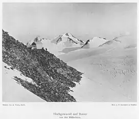
The Botzer is a mountain in the Stubai Alps in South Tyrol, Italy.
References
- Walter Klier, Alpenvereinsführer Stubaier Alpen, München 2006, ISBN 3-7633-1271-4
- Eduard Richter, Die Erschließung der Ostalpen, II. Band, Berlin, Verlag des Deutschen und Oesterreichischen Alpenvereins, 1894
- Casa Editrice Tabacco, carta topografica 1:25.000, Blatt 038, Vipiteno, Alpi Breonie / Sterzing,StubaierAlpen
- Alpenvereinskarte 1:25.000, Blatt 31/1 Stubaier Alpen, Hochstubai
External links
![]() Media related to Botzer at Wikimedia Commons
Media related to Botzer at Wikimedia Commons
This article is issued from Wikipedia. The text is licensed under Creative Commons - Attribution - Sharealike. Additional terms may apply for the media files.