Monoharpur | |
|---|---|
Village | |
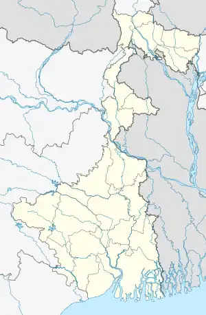 Monoharpur Location in West Bengal, India  Monoharpur Monoharpur (India) | |
| Coordinates: 22°41′N 88°18′E / 22.68°N 88.30°E | |
| Country | |
| State | West Bengal |
| District | Hooghly |
| Population (2011) | |
| • Total | 20,825 |
| Languages | |
| • Official | Bengali, English |
| Time zone | UTC+5:30 (IST) |
| PIN | 712410[1] |
| Vehicle registration | WB |
| Website | wb |
Monoharpur is a village in Chanditala II CD Block in Srirampore subdivision of Hooghly district in the state of West Bengal, India. It was earlier recorded as a census town.[2][3]
Geography
Manoharpur is located at 22°41′N 88°18′E / 22.68°N 88.30°E.[4]
Demographics
As of 2001 India census,[5] Manoharpur had a population of 20,825. Males constitute 53% of the population and females 47%. Manoharpur has an average literacy rate of 72%, higher than the national average of 59.5%: male literacy is 75%, and female literacy is 69%. In Manoharpur, 11% of the population is under 6 years of age.
References
- ↑ "Manoharpur Pin code". pin-code.net. Retrieved 23 July 2021.
- ↑ "Mouza Information". Land & Land Reforms Department, Government of West Bengal. Archived from the original on 22 December 2016. Retrieved 16 October 2018.
- ↑ "District-wise list of stautory towns". Census Commission of India. Archived from the original on 30 September 2007. Retrieved 28 January 2009.
- ↑ "Yahoo maps of Manoharpur". Yahoo maps. Retrieved 29 November 2008.
- ↑ "Census of India 2001: Data from the 2001 Census, including cities, villages and towns (Provisional)". Census Commission of India. Archived from the original on 16 June 2004. Retrieved 1 November 2008.
Cities, towns and locations in Hooghly district | |||||||||
|---|---|---|---|---|---|---|---|---|---|
| Cities, municipalities and census towns |
| ||||||||
| Locations other than cities and towns |
| ||||||||
| Neighbourhoods | |||||||||
| Related topics |
| ||||||||
This article is issued from Wikipedia. The text is licensed under Creative Commons - Attribution - Sharealike. Additional terms may apply for the media files.