En Nahud
النهود | |
|---|---|
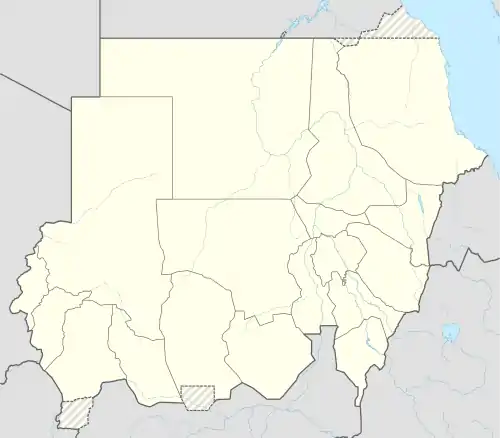 En Nahud Location in Sudan (North Kurdufan state highlighted) | |
| Coordinates: 12°41′33″N 28°25′24″E / 12.69250°N 28.42333°E | |
| Country | |
| State | North Kurdufan |
En Nahud (Arabic: النهود) is a town in the desert of central Sudan. Formerly located within the Sudanese political division of West Kurdufan,[1] it is now part of the country's North Kurdufan state.
History
In 2021, the Darsaya gold mine in the town collapsed, leading to the deaths of at least 38 people.[2]
Climate
En Nahud has a hot desert climate (Köppen climate classification BWh).
| Climate data for En Nahud (1961–1990, extremes 1911–present) | |||||||||||||
|---|---|---|---|---|---|---|---|---|---|---|---|---|---|
| Month | Jan | Feb | Mar | Apr | May | Jun | Jul | Aug | Sep | Oct | Nov | Dec | Year |
| Record high °C (°F) | 43.0 (109.4) |
42.5 (108.5) |
44.4 (111.9) |
45.0 (113.0) |
46.0 (114.8) |
43.3 (109.9) |
41.2 (106.2) |
40.0 (104.0) |
41.0 (105.8) |
42.0 (107.6) |
41.5 (106.7) |
39.5 (103.1) |
46.0 (114.8) |
| Mean daily maximum °C (°F) | 31.1 (88.0) |
33.6 (92.5) |
36.6 (97.9) |
39.4 (102.9) |
39.6 (103.3) |
37.4 (99.3) |
33.7 (92.7) |
32.9 (91.2) |
34.8 (94.6) |
36.9 (98.4) |
34.5 (94.1) |
31.5 (88.7) |
35.2 (95.4) |
| Daily mean °C (°F) | 22.1 (71.8) |
24.3 (75.7) |
27.7 (81.9) |
30.4 (86.7) |
31.7 (89.1) |
30.7 (87.3) |
28.4 (83.1) |
27.7 (81.9) |
28.6 (83.5) |
29.2 (84.6) |
25.9 (78.6) |
22.7 (72.9) |
27.5 (81.5) |
| Mean daily minimum °C (°F) | 13.2 (55.8) |
14.9 (58.8) |
18.8 (65.8) |
21.4 (70.5) |
23.7 (74.7) |
23.9 (75.0) |
23.1 (73.6) |
22.6 (72.7) |
22.4 (72.3) |
21.5 (70.7) |
17.4 (63.3) |
13.9 (57.0) |
19.7 (67.5) |
| Record low °C (°F) | 5.8 (42.4) |
6.5 (43.7) |
10.2 (50.4) |
11.0 (51.8) |
16.4 (61.5) |
14.6 (58.3) |
18.2 (64.8) |
18.0 (64.4) |
18.5 (65.3) |
12.9 (55.2) |
7.8 (46.0) |
6.4 (43.5) |
5.8 (42.4) |
| Average precipitation mm (inches) | 0.0 (0.0) |
0.0 (0.0) |
0.5 (0.02) |
1.7 (0.07) |
10.1 (0.40) |
45.7 (1.80) |
105.0 (4.13) |
115.3 (4.54) |
44.3 (1.74) |
13.3 (0.52) |
0.0 (0.0) |
0.0 (0.0) |
335.9 (13.22) |
| Average precipitation days (≥ 0.1 mm) | 0.0 | 0.0 | 0.1 | 0.6 | 1.8 | 5.3 | 9.8 | 11.3 | 7.2 | 2.4 | 0.0 | 0.0 | 38.5 |
| Average relative humidity (%) | 20 | 16 | 14 | 16 | 29 | 42 | 59 | 68 | 62 | 38 | 23 | 24 | 34.2 |
| Mean monthly sunshine hours | 310.0 | 288.4 | 300.7 | 303.0 | 294.5 | 255.0 | 226.3 | 229.4 | 243.0 | 288.3 | 312.0 | 322.4 | 3,373 |
| Percent possible sunshine | 89 | 87 | 81 | 82 | 76 | 68 | 58 | 58 | 68 | 80 | 91 | 92 | 77 |
| Source 1: NOAA[3] | |||||||||||||
| Source 2: Meteo Climat (record highs and lows)[4] | |||||||||||||
Transportation
It is served by En Nahud Airport.
References
- ↑ Sudan Darfur unosat-maps.web.cern.ch
- ↑ "Gold mine collapse in Sudan kills at least 38". Al Jazeera. December 29, 2021. Retrieved December 29, 2021.
- ↑ "En Nahud Climate Normals 1961–1990". National Oceanic and Atmospheric Administration. Retrieved January 18, 2016.
- ↑ "Station En–Nahud" (in French). Meteo Climat. Retrieved 22 October 2016.
This article is issued from Wikipedia. The text is licensed under Creative Commons - Attribution - Sharealike. Additional terms may apply for the media files.