Quỳnh Lưu District
Huyện Quỳnh Lưu | |
|---|---|
| Country | |
| Region | North Central Coast |
| Province | Nghệ An |
| Capital | Cầu Giát |
| Area | |
| • Total | 168.9694 sq mi (437.6287 km2) |
| Population (03 April 2013) | |
| • Total | 279,977 |
| • Density | 1,657/sq mi (639.7/km2) |
| Time zone | UTC+07:00 (Indochina Time) |
Quỳnh Lưu is a rural district of Nghệ An province, in the northmost part of the lanky Central Coast region of Vietnam. As of 2003 the district had a population of 353,650.[1] The district covers an area of 609 km2. The district capital lies at Cầu Giát.[1]
Climate
| Climate data for Quỳnh Lưu | |||||||||||||
|---|---|---|---|---|---|---|---|---|---|---|---|---|---|
| Month | Jan | Feb | Mar | Apr | May | Jun | Jul | Aug | Sep | Oct | Nov | Dec | Year |
| Record high °C (°F) | 32.8 (91.0) |
34.3 (93.7) |
36.4 (97.5) |
39.3 (102.7) |
40.4 (104.7) |
39.2 (102.6) |
39.7 (103.5) |
38.5 (101.3) |
37.4 (99.3) |
34.5 (94.1) |
33.6 (92.5) |
30.7 (87.3) |
40.4 (104.7) |
| Mean daily maximum °C (°F) | 20.5 (68.9) |
21.0 (69.8) |
23.4 (74.1) |
27.5 (81.5) |
31.5 (88.7) |
33.3 (91.9) |
33.2 (91.8) |
32.1 (89.8) |
30.6 (87.1) |
28.2 (82.8) |
25.4 (77.7) |
22.1 (71.8) |
27.4 (81.3) |
| Daily mean °C (°F) | 17.5 (63.5) |
18.2 (64.8) |
20.4 (68.7) |
24.0 (75.2) |
27.5 (81.5) |
29.2 (84.6) |
29.3 (84.7) |
28.3 (82.9) |
27.0 (80.6) |
24.8 (76.6) |
21.9 (71.4) |
18.7 (65.7) |
23.9 (75.0) |
| Mean daily minimum °C (°F) | 15.4 (59.7) |
16.5 (61.7) |
18.6 (65.5) |
21.8 (71.2) |
24.7 (76.5) |
26.2 (79.2) |
26.3 (79.3) |
25.6 (78.1) |
24.5 (76.1) |
22.3 (72.1) |
19.3 (66.7) |
16.2 (61.2) |
21.4 (70.5) |
| Record low °C (°F) | 5.7 (42.3) |
7.1 (44.8) |
8.4 (47.1) |
13.3 (55.9) |
17.7 (63.9) |
19.8 (67.6) |
21.4 (70.5) |
21.5 (70.7) |
17.6 (63.7) |
14.4 (57.9) |
9.1 (48.4) |
5.5 (41.9) |
5.5 (41.9) |
| Average precipitation mm (inches) | 17.8 (0.70) |
21.3 (0.84) |
30.7 (1.21) |
54.1 (2.13) |
103.2 (4.06) |
132.7 (5.22) |
133.2 (5.24) |
243.5 (9.59) |
409.0 (16.10) |
351.6 (13.84) |
95.2 (3.75) |
32.0 (1.26) |
1,624.2 (63.94) |
| Average rainy days | 8.8 | 10.2 | 11.3 | 9.9 | 10.9 | 9.2 | 9.1 | 13.5 | 14.9 | 13.8 | 9.0 | 6.7 | 127.4 |
| Average relative humidity (%) | 86.2 | 88.3 | 89.9 | 89.0 | 84.4 | 80.2 | 80.4 | 85.0 | 86.1 | 84.5 | 83.2 | 83.1 | 85.0 |
| Mean monthly sunshine hours | 78.4 | 60.2 | 73.4 | 132.1 | 216.7 | 200.9 | 216.7 | 183.9 | 161.5 | 148.2 | 123.0 | 101.3 | 1,692.6 |
| Source: Vietnam Institute for Building Science and Technology[2] | |||||||||||||
References
- 1 2 "Districts of Vietnam". Statoids. Retrieved March 20, 2009.
- ↑ "Vietnam Institute for Building Science and Technology" (PDF). Retrieved 16 August 2023.
19°10′01″N 105°40′01″E / 19.167°N 105.667°E
| Thanh Hóa province | 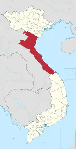 | |
|---|---|---|
| Nghệ An province | ||
| Hà Tĩnh province | ||
| Quảng Bình province |
| |
| Quảng Trị province | ||
| Thừa Thiên Huế province |
| |
※ denotes provincial seat. | ||
This article is issued from Wikipedia. The text is licensed under Creative Commons - Attribution - Sharealike. Additional terms may apply for the media files.