Rackith | |
|---|---|
Location of Rackith | |
 Rackith 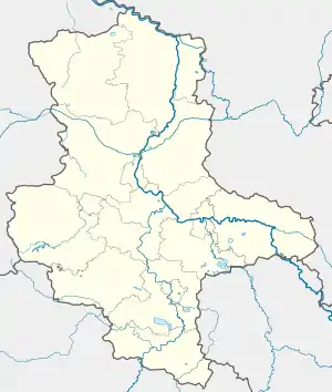 Rackith | |
| Coordinates: 51°48′N 12°41′E / 51.800°N 12.683°E | |
| Country | Germany |
| State | Saxony-Anhalt |
| District | Wittenberg |
| Town | Kemberg |
| Subdivisions | 2 |
| Area | |
| • Total | 18.99 km2 (7.33 sq mi) |
| Elevation | 67 m (220 ft) |
| Population (2006-12-31) | |
| • Total | 663 |
| • Density | 35/km2 (90/sq mi) |
| Time zone | UTC+01:00 (CET) |
| • Summer (DST) | UTC+02:00 (CEST) |
| Postal codes | 06901 |
| Dialling codes | 034927 |
| Website | www.vgem-kemberg.de |
Rackith is a village and a former municipality in Wittenberg district in Saxony-Anhalt, Germany. Since 1 January 2010, it is part of the town Kemberg.
Geography
Rackith lies about 12 km southeast of Lutherstadt Wittenberg.
Subdivisions
Rackith has two of these: Lammsdorf and Bietegast.
History
Rackith had its first documentary mention in 1004.

Railway station
Economy and transportation
Federal Highway (Bundesstraße) B 182 between Wittenberg and Torgau runs right through the community. Rackith railway station lies on the single-track line between Wittenberg and Bad Schmiedeberg.
References
External links
This article is issued from Wikipedia. The text is licensed under Creative Commons - Attribution - Sharealike. Additional terms may apply for the media files.