Ruiselede | |
|---|---|
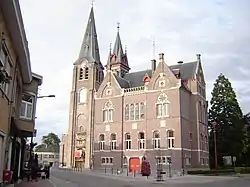 Village centre, with town hall and church of Our Lady | |
 Flag  Coat of arms | |
Location of Ruiselede | |
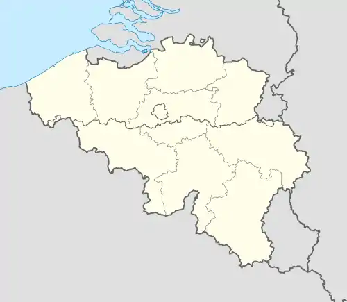 Ruiselede Location in Belgium
Location of Ruiselede in West Flanders 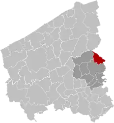 | |
| Coordinates: 51°02′N 03°23′E / 51.033°N 3.383°E | |
| Country | |
| Community | Flemish Community |
| Region | Flemish Region |
| Province | West Flanders |
| Arrondissement | Tielt |
| Government | |
| • Mayor | Greet De Roo (RKD) |
| • Governing party/ies | RKD |
| Area | |
| • Total | 30.62 km2 (11.82 sq mi) |
| Population (2018-01-01)[1] | |
| • Total | 5,387 |
| • Density | 180/km2 (460/sq mi) |
| Postal codes | 8755 |
| NIS code | 37012 |
| Area codes | 051 |
| Website | www.ruiselede.be |
Ruiselede (Dutch pronunciation: [ˈrœy̯səˌleːdə]; West Flemish: Ruuslee; historically Ruysselede) is a municipality located in the Belgian province of West Flanders. This town only comprises the town of Ruiselede proper. On January 1, 2006, Ruiselede had a total population of 5,113. The total area is 30.20 km2 which gives a population density of 169 inhabitants per km2.
Ruiselede was the location of a coastal radio site. From 1923 to 1940 it had a VLF aerial. On 30 December 1933, the mast was demolished when an aircraft collided with it.
Gallery
![Onze-Lieve-Vrouw-ten-Hemelopnemingskerk (Ruiselede) [nl]](../I/Onze-Lieve-Vlouv-ten-Hemelopnemingskerk%252C_Ruiselede_(DSCF0084).jpg.webp) Onze-Lieve-Vrouw-ten-Hemelopnemingskerk (Ruiselede)
Onze-Lieve-Vrouw-ten-Hemelopnemingskerk (Ruiselede)
References
- ↑ "Wettelijke Bevolking per gemeente op 1 januari 2018". Statbel. Retrieved 9 March 2019.
External links
 Media related to Ruiselede at Wikimedia Commons
| Bruges |  | |
|---|---|---|
| Diksmuide | ||
| Kortrijk | ||
| Ostend | ||
| Roeselare | ||
| Tielt | ||
| Veurne | ||
| Ypres | ||
| ||
This article is issued from Wikipedia. The text is licensed under Creative Commons - Attribution - Sharealike. Additional terms may apply for the media files.