| Sims | |
|---|---|
 | |
| Location | |
| Country | Germany |
| State | Bavaria |
| Physical characteristics | |
| Source | |
| • location | Simssee |
| • elevation | 470 m (1,540 ft) |
| Mouth | |
• location | into Rohrdorfer Achen near Rosenheim |
• elevation | 443 m (1,453 ft) |
| Length | 6 km (3.7 mi) |
| Basin size | 97 km2 (37 sq mi) |
| Basin features | |
| Progression | Rohrdorfer Achen→ Inn→ Danube→ Black Sea |
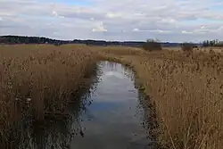
Sims is a river of Bavaria, Germany, near the country's southern border. It is approximately six kilometers long, and is fed by the Simssee, a small lake. It flows into the Rohrdorfer Achen, close to its confluence with the Inn, near Rosenheim.
See also
47°51′N 12°13′E / 47.850°N 12.217°E
This article is issued from Wikipedia. The text is licensed under Creative Commons - Attribution - Sharealike. Additional terms may apply for the media files.