Ambohijanaka | |
|---|---|
 Church in Ambohijanaka | |
 Ambohijanaka Location in Madagascar | |
| Coordinates: 18°59′00″S 47°33′00″E / 18.98333°S 47.55000°E | |
| Country | |
| Region | Analamanga |
| District | Antananarivo-Atsimondrano |
| Government | |
| • Mayor | RATSIMBAZAFY Alain Jean |
| Area | |
| • Total | 23 km2 (9 sq mi) |
| Elevation | 1,260 m (4,130 ft) |
| Population (2018) | |
| • Total | 27,088 |
| Time zone | UTC3 (EAT) |
| postal code | 102 |
Ambohijanaka is a suburb and a rural commune in Analamanga Region, in the Central Highlands of Madagascar. It belongs to the district of Antananarivo-Atsimondrano and its populations numbers to 27,088 in 2018.[2]
Roads
This municipality can be accessed by the National road 7 and National road 2 from Antananarivo
Bodies of water
The Nanganoana lake and Varahana river, an affluent of the Ikopa River.
Infrastructures
All villages of this municipality are connected to electricity.
References
- ↑ Monographie de la Commune d’AMBOHIJANAKA
- ↑ RECENSEMENT GÉNÉRAL DE LA POPULATION ET DE L’HABITATION DE 2018 DE MADAGASCAR
Capital: Antananarivo | ||
| Ambohidratrimo (24) - 105 | 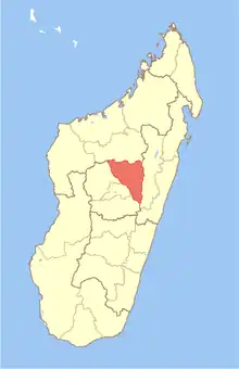 | |
| Andramasina (14) - 106 | ||
| Anjozorobe (18) - 107 | ||
| Ankazobe (15) - 108 | ||
| Antananarivo-Atsimondrano (26) - 102 |
| |
| Antananarivo-Avaradrano (16) - 103 | ||
| Antananarivo-Renivohitra (1) - 101 | ||
| Manjakandriana (23) - 116 | ||
8 districts; 137 communes | ||
This article is issued from Wikipedia. The text is licensed under Creative Commons - Attribution - Sharealike. Additional terms may apply for the media files.