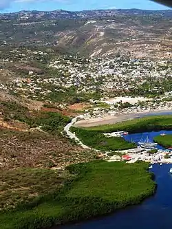
Anse-à-Galets
| |
|---|---|
 | |
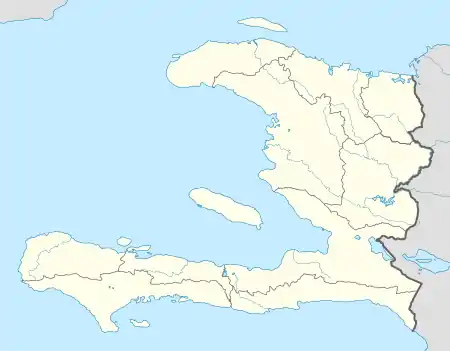 Anse-à-Galets Location in Haiti | |
| Coordinates: 18°50′0″N 72°52′0″W / 18.83333°N 72.86667°W | |
| Country | Haiti |
| Department | Ouest |
| Arrondissement | La Gonâve |
| Area | |
| • Total | 372.01 km2 (143.63 sq mi) |
| Elevation | 16 m (52 ft) |
| Population (March, 2015)[1] | |
| • Total | 62,559 |
| • Density | 168/km2 (440/sq mi) |
Anse-à-Galets (Haitian Creole: Ansagalèt) is a commune and city in the La Gonâve Arrondissement, in the Ouest department on Gonâve Island in Haiti, located to the west-northwest of Port-au-Prince in the Gulf of Gonâve. It is the largest commune on the island and has 62,559 inhabitants.
The current mayor of the city of Anse-a-Galets is Ernso Louissaint.
Transportation
The commune is served by Anse-à-Galets Airport and a public wharf. The public wharf has daily ferry traffic to the Haitian mainland at the Carries Ferry terminal.
References
- ↑ "Mars 2015 Population Totale, Population de 18 ans et Plus Menages et Densites Estimes en 2015" (PDF). Institut Haïtien de Statistique et d’Informatique (IHSI). Archived from the original (PDF) on 6 November 2015. Retrieved 3 June 2017.
This article is issued from Wikipedia. The text is licensed under Creative Commons - Attribution - Sharealike. Additional terms may apply for the media files.