38°26′31″N 48°52′55″E / 38.442°N 48.882°E
| Astarachay Astaraçay, آستاراچای | |
|---|---|
| Location | |
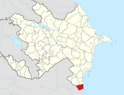
| Countries | Iran and Azerbaijan |
| Province | Gilan, Iran |
| District | Astara, Azerbaijan |
| Cities | Astara, Iran Astara Azerbaijan |
| Physical characteristics | |
| Mouth | Caspian Sea |
| Length | 38 km (24 mi) |
| Basin size | 242 km2 (93 sq mi) |
The Astarachay (Talysh: Ostororü, Persian: آستاراچای, Azerbaijani: Astaraçay), is a small river that defines the eastern border between Iran and Azerbaijan in Western Asia.[1]
The river is a tributary of the Caspian Sea. After flowing in a canyon through the Alborz mountain range, it reaches its river mouth on the southwestern Caspian coast.
The Astarachay is partially in Gilan Province of far northwestern Iran.
See also
- Tributaries of the Caspian Sea
- Alborz mountain range topics
- Landforms of Gilan Province
External links
- Aerial Map: Astarachay
- Astarachay Archived 2013-07-22 at the Wayback Machine
References
| Lake Urmia basin | |
|---|---|
| Persian Gulf basin | |
| Oman sea basin | |
| Caspian basin | |
| Gavkhouni basin | |
| Namak Lake basin | |
| Hamun-e Jaz Murian basin | |
| Other | |
| Capital | 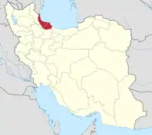 | |
|---|---|---|
| Counties and cities | ||
| Sights |
| |
| Populated places | ||
This article is issued from Wikipedia. The text is licensed under Creative Commons - Attribution - Sharealike. Additional terms may apply for the media files.