Averill | |
|---|---|
 Averill  Averill | |
| Coordinates: 46°58′15″N 96°32′50″W / 46.97083°N 96.54722°W | |
| Country | United States |
| State | Minnesota |
| County | Clay |
| Elevation | 915 ft (279 m) |
| Time zone | UTC-6 (Central (CST)) |
| • Summer (DST) | UTC-5 (CDT) |
| Area code | 218 |
| GNIS feature ID | 639538[1] |
Averill is an unincorporated community in Clay County, in the U.S. state of Minnesota.[1]
History
A post office was established at Averill in 1899, and remained in operation until being discontinued in 1969.[2][3] The community was named for John T. Averill, an officer in the Civil War and Minnesota legislator.[4]
References
- 1 2 U.S. Geological Survey Geographic Names Information System: Averill, Minnesota
- ↑ "Clay County". Jim Forte Postal History. Retrieved April 3, 2015.
- ↑ U.S. Geological Survey Geographic Names Information System: Averill Post Office (historical)
- ↑ Upham, Warren (1920). Minnesota Geographic Names: Their Origin and Historic Significance. Minnesota Historical Society. p. 115.
Municipalities and communities of Clay County, Minnesota, United States | ||
|---|---|---|
| Cities | 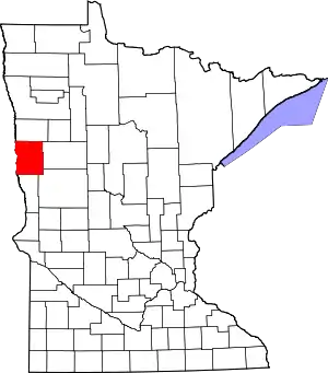 Map of Minnesota highlighting Clay County | |
| Townships | ||
| CDPs | ||
| Unincorporated communities | ||
| Ghost towns | ||
This article is issued from Wikipedia. The text is licensed under Creative Commons - Attribution - Sharealike. Additional terms may apply for the media files.