33°36′36″N 109°06′24″W / 33.610055°N 109.10674°W
Blue, Arizona | |
|---|---|
| Coordinates: 32.9316684 N, -109.2139416 W | |
| Country | United States |
| State | Arizona |
| County | Greenlee |
| Population (2000) | |
| • Total | 36 |
| Time zone | UTC-7 (MST (no DST)) |
| ZIP code | 85922 |
| Area code | 928 |
Blue (originally, Whittum) is an unincorporated community in Greenlee County, Arizona, United States. It lies 33°36′36″N 109°6′24″W / 33.61000°N 109.10667°W (33.6100552, -109.1067396), at an elevation of 5,758 feet (1,755 m).
Blue has a ZIP Code of 85922; in 2000, the population of the 85922 ZCTA was 36.[1] In addition to its post office, Blue also contains a public library, and a public school serving all grade levels.
History
The community was originally named for Nat Whittum, an original settler who was killed at the site in 1891. A post office was established at Whittum in 1894; however, its name was changed to Blue in 1898, because everyone knew where the Blue River was but Whittum was not known.[2]
Blue's population was 80 in 1940.[3]
Climate
| Climate data for Blue, Arizona, 1903–1989 | |||||||||||||
|---|---|---|---|---|---|---|---|---|---|---|---|---|---|
| Month | Jan | Feb | Mar | Apr | May | Jun | Jul | Aug | Sep | Oct | Nov | Dec | Year |
| Mean daily maximum °F (°C) | 53.5 (11.9) |
58.1 (14.5) |
62.6 (17.0) |
70.6 (21.4) |
78.9 (26.1) |
88.3 (31.3) |
88.9 (31.6) |
85.7 (29.8) |
80.8 (27.1) |
72.4 (22.4) |
61.8 (16.6) |
54.3 (12.4) |
71.3 (21.8) |
| Mean daily minimum °F (°C) | 18.6 (−7.4) |
21.1 (−6.1) |
24.5 (−4.2) |
29.4 (−1.4) |
36.0 (2.2) |
44.3 (6.8) |
52.5 (11.4) |
51.4 (10.8) |
45.2 (7.3) |
34.3 (1.3) |
24.6 (−4.1) |
19.1 (−7.2) |
33.4 (0.8) |
| Average precipitation inches (mm) | 1.35 (34) |
1.30 (33) |
1.27 (32) |
0.70 (18) |
0.50 (13) |
0.68 (17) |
3.90 (99) |
3.69 (94) |
2.27 (58) |
2.13 (54) |
1.14 (29) |
1.79 (45) |
20.73 (527) |
| Average snowfall inches (cm) | 5.3 (13) |
5.9 (15) |
2.8 (7.1) |
1.0 (2.5) |
0.0 (0.0) |
0.0 (0.0) |
0.0 (0.0) |
0.0 (0.0) |
0.0 (0.0) |
0.3 (0.76) |
1.7 (4.3) |
7.6 (19) |
24.6 (62) |
| Average precipitation days (≥ 0.01 in) | 4 | 5 | 5 | 3 | 2 | 3 | 12 | 12 | 7 | 4 | 4 | 5 | 66 |
| Source: WRCC[4] | |||||||||||||
Education
Blue School District 22 is the area school district, serving K-12. In 1984 Randy Collier of The Arizona Republic stated due to difficulties in transportation and from being far from other places, "the social life at Blue primarily is at the school."[5]
Previously Blue had a K-8 school, so Round Valley High School in Eagar, of the Round Valley Unified School District, served Blue for high school; some students lived with relatives in Eagar and some traveled to and from Eagar via school bus.[6]
Greenlee County Library System maintains the Blue Public Library in a log cabin adjacent to the Blue School.[7]
References
- ↑ "American FactFinder - Community Facts". Archived from the original on February 12, 2020. Retrieved July 13, 2010.
- ↑ U.S. Geological Survey Geographic Names Information System: Blue, Arizona
- ↑ The Attorneys List. United States Fidelity and Guaranty Company, Attorney List Department. 1940. p. 85.
- ↑ "BLUE, ARIZONA (020855)". Western Regional Climate Center. Retrieved December 16, 2022.
- ↑ Collier, Randy (February 5, 1984). "No room to spare for pupils". The Arizona Republic. Vol. 94, no. 265. pp. A1, A14. - Clipping of first and of second page (text detail A, text detail B, text detail C) at Newspapers.com.
- ↑ Smith, Kim (July 20, 2021). "The Blue School - Former student finds a home, family in one-room school house". The Copper Era. Retrieved July 17, 2022.
- ↑ "Blue Public Library". Greenlee County Library System. Retrieved July 18, 2022. - Address is given as adjacent to the Blue School
Municipalities and communities of Greenlee County, Arizona, United States | ||
|---|---|---|
| Towns | 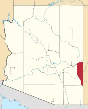 | |
| CDPs | ||
| Populated places | ||
| Ghost towns | ||