Boʻrbaliq
Burbalyk | |
|---|---|
Town | |
 Boʻrbaliq Location in Oltiariq District | |
| Coordinates: 40°19′29″N 71°22′09″E / 40.32472°N 71.36917°E | |
| Country | |
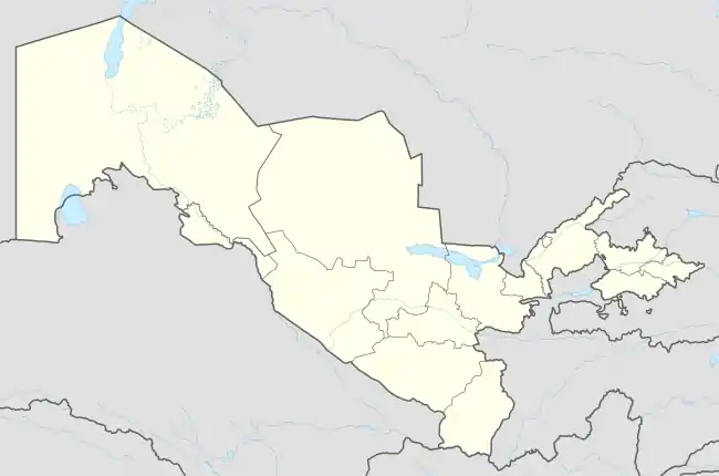
| Region | Fergana Region |
| District | Oltiariq District |
| Town status | 2009 |
| Elevation | 480 m (1,570 ft) |
| Highest elevation | 600 m (2,000 ft) |
| Lowest elevation | 420 m (1,380 ft) |
| Population (2016) | |
| • Total | 16,600 |
| Time zone | UTC+5 (UZT) |
| Postal code | 151201 |
Boʻrbaliq (Uzbek: Boʻrbaliq / Бўрбалиқ[1] or Burbaliq / Бурбалиқ,[2] Russian: Бурбалык, romanized: Burbalyk[3]) is an urban-type settlement in Oltiariq District of Fergana Region.[1][3] It is located on an elevation of 500 metres above the sea level. Boʻrbaliq is known for the 18th-19th century "Doʻsti Xudo" mosque.[2] The town population was 16,600 in 2016.[4] In 2009, Boʻrbaliq was given urban settlement status.[3] The local time is UTC(+5) (UZT).
See also
References
- 1 2 "Classification system of territorial units of the Republic of Uzbekistan" (in Uzbek and Russian). The State Committee of the Republic of Uzbekistan on statistics. July 2020.
- 1 2 "Олтиариқ тумани" [Oltiariq District] (PDF). National Encyclopedia of Uzbekistan (in Uzbek). Tashkent. 2000–2005. pp. 140–141.
{{cite encyclopedia}}: CS1 maint: location missing publisher (link) - 1 2 3 "Decree 13.03.2009 № 68, On additional measures to improve the administrative and territorial development of the settlements of the Republic of Uzbekistan". LexUZ (in Russian).
- ↑ Soliyev, A.S. Shaharlar geografiyasi [Geography of cities] (PDF) (in Uzbek). p. 168.
External links
Capital: Fergana | ||
| Districts | 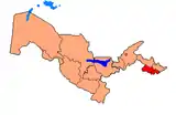 | |
| Cities | ||
| Towns | ||
| Villages | ||
This article is issued from Wikipedia. The text is licensed under Creative Commons - Attribution - Sharealike. Additional terms may apply for the media files.