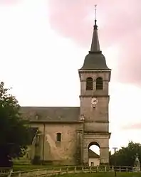
Champdor | |
|---|---|
Part of Champdor-Corcelles | |
 | |
.svg.png.webp) Coat of arms | |
Location of Champdor | |
 Champdor 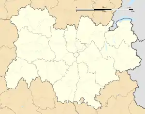 Champdor | |
| Coordinates: 46°01′05″N 5°35′52″E / 46.0181°N 5.5978°E | |
| Country | France |
| Region | Auvergne-Rhône-Alpes |
| Department | Ain |
| Arrondissement | Belley |
| Canton | Plateau d'Hauteville |
| Commune | Champdor-Corcelles |
| Area 1 | 17.37 km2 (6.71 sq mi) |
| Population (2019)[1] | 441 |
| • Density | 25/km2 (66/sq mi) |
| Time zone | UTC+01:00 (CET) |
| • Summer (DST) | UTC+02:00 (CEST) |
| Postal code | 01110 |
| Elevation | 798–1,183 m (2,618–3,881 ft) (avg. 826 m or 2,710 ft) |
| 1 French Land Register data, which excludes lakes, ponds, glaciers > 1 km2 (0.386 sq mi or 247 acres) and river estuaries. | |
Champdor (French pronunciation: [ʃɑ̃dɔʁ] ⓘ) is a former commune in the Ain department in eastern France. On 1 January 2016, it was merged into the new commune Champdor-Corcelles.[2]
Geography
The river Albarine forms part of the commune's northwestern border, then flows south through the commune.
Population
| Year | Pop. | ±% |
|---|---|---|
| 2006 | 438 | — |
| 2007 | 440 | +0.5% |
| 2008 | 450 | +2.3% |
| 2009 | 462 | +2.7% |
| 2010 | 464 | +0.4% |
| 2011 | 465 | +0.2% |
| 2012 | 466 | +0.2% |
| 2013 | 452 | −3.0% |
| 2014 | 452 | +0.0% |
| 2015 | 455 | +0.7% |
See also
References
- ↑ Téléchargement du fichier d'ensemble des populations légales en 2019, INSEE
- ↑ Arrêté préfectoral Archived 2016-03-17 at the Wayback Machine 27 November 2015 (in French)
Wikimedia Commons has media related to Champdor.
This article is issued from Wikipedia. The text is licensed under Creative Commons - Attribution - Sharealike. Additional terms may apply for the media files.