Chantepie
| |
|---|---|
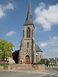 Saint Martin church | |
Location of Chantepie | |
 Chantepie  Chantepie | |
| Coordinates: 48°05′21″N 1°36′55″W / 48.0892°N 1.6153°W | |
| Country | France |
| Region | Brittany |
| Department | Ille-et-Vilaine |
| Arrondissement | Rennes |
| Canton | Rennes-3 |
| Intercommunality | Rennes Métropole |
| Government | |
| • Mayor (2020–2026) | Gilles Dreuslin[1] (PS) |
| Area 1 | 11.98 km2 (4.63 sq mi) |
| Population | 10,232 |
| • Density | 850/km2 (2,200/sq mi) |
| Time zone | UTC+01:00 (CET) |
| • Summer (DST) | UTC+02:00 (CEST) |
| INSEE/Postal code | 35055 /35135 |
| Elevation | 32–77 m (105–253 ft) |
| 1 French Land Register data, which excludes lakes, ponds, glaciers > 1 km2 (0.386 sq mi or 247 acres) and river estuaries. | |
Chantepie (French pronunciation: [ʃɑ̃tpi]; Breton: Kantpig; Gallo: Chauntepiy) is a commune of Rennes Métropole located in the Ille-et-Vilaine department in Brittany in northwestern France.
Population
Inhabitants of Chantepie are called Cantepiens in French.
| Year | Pop. | ±% p.a. |
|---|---|---|
| 1968 | 1,594 | — |
| 1975 | 2,651 | +7.54% |
| 1982 | 3,677 | +4.78% |
| 1990 | 5,898 | +6.08% |
| 1999 | 6,793 | +1.58% |
| 2007 | 8,003 | +2.07% |
| 2012 | 10,222 | +5.02% |
| 2017 | 10,435 | +0.41% |
| Source: INSEE[3] | ||
See also
References
- ↑ "Répertoire national des élus: les maires" (in French). data.gouv.fr, Plateforme ouverte des données publiques françaises. 13 September 2022.
- ↑ "Populations légales 2021". The National Institute of Statistics and Economic Studies. 28 December 2023.
- ↑ Population en historique depuis 1968, INSEE
External links
Wikimedia Commons has media related to Chantepie.
- Official website (in French)
- Mayors of Ille-et-Vilaine Association Archived 14 January 2012 at the Wayback Machine (in French)
This article is issued from Wikipedia. The text is licensed under Creative Commons - Attribution - Sharealike. Additional terms may apply for the media files.