Chemin-d'Aisey | |
|---|---|
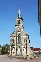 The church in Chemin-d'Aisey | |
.svg.png.webp) Coat of arms | |
Location of Chemin-d'Aisey | |
 Chemin-d'Aisey 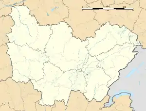 Chemin-d'Aisey | |
| Coordinates: 47°44′31″N 4°33′56″E / 47.7419°N 4.5656°E | |
| Country | France |
| Region | Bourgogne-Franche-Comté |
| Department | Côte-d'Or |
| Arrondissement | Montbard |
| Canton | Châtillon-sur-Seine |
| Intercommunality | Pays Châtillonnais |
| Government | |
| • Mayor (2020–2026) | Jean-Pierre Moiret[1] |
| Area 1 | 8.51 km2 (3.29 sq mi) |
| Population | 67 |
| • Density | 7.9/km2 (20/sq mi) |
| Time zone | UTC+01:00 (CET) |
| • Summer (DST) | UTC+02:00 (CEST) |
| INSEE/Postal code | 21165 /21400 |
| Elevation | 290–389 m (951–1,276 ft) (avg. 317 m or 1,040 ft) |
| 1 French Land Register data, which excludes lakes, ponds, glaciers > 1 km2 (0.386 sq mi or 247 acres) and river estuaries. | |
Chemin-d'Aisey (French pronunciation: [ʃəmɛ̃ dɛzɛ], literally Way of Aisey) is a commune in the Côte-d'Or department in eastern France.
Population
| Year | Pop. | ±% |
|---|---|---|
| 1962 | 110 | — |
| 1968 | 114 | +3.6% |
| 1975 | 83 | −27.2% |
| 1982 | 67 | −19.3% |
| 1990 | 80 | +19.4% |
| 1999 | 70 | −12.5% |
| 2008 | 55 | −21.4% |
See also
References
- ↑ "Répertoire national des élus: les maires" (in French). data.gouv.fr, Plateforme ouverte des données publiques françaises. 13 September 2022.
- ↑ "Populations légales 2021". The National Institute of Statistics and Economic Studies. 28 December 2023.
Wikimedia Commons has media related to Chemin-d'Aisey.
This article is issued from Wikipedia. The text is licensed under Creative Commons - Attribution - Sharealike. Additional terms may apply for the media files.