Chitagá | |
|---|---|
Municipality and town | |
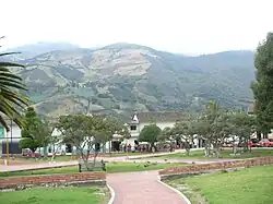 Chitagá's main square | |
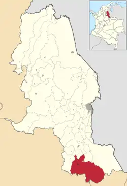 Location of the municipality and town of Chitagá in the Norte de Santander Department of Colombia. | |
| Coordinates: 7°08′16″N 72°39′52″O | |
| Country | |
| Department | Norte de Santander Department |
| Area | |
| • Total | 1,172 km2 (453 sq mi) |
| Elevation | 2,350 m (7,710 ft) |
| Population (Census 2018[2]) | |
| • Total | 10,554 |
| • Density | 9.0/km2 (23/sq mi) |
| Time zone | UTC-5 (Colombia Standard Time) |
| Climate | Cfb |
Chitagá (Spanish pronunciation: [tʃitaˈɣa]) is a Colombian municipality and town located in the department of North Santander. The town has a population of 11,684 people and an elevation of 2,350 metres above sea level.
References
- ↑ "Municipalities of Colombia". statoids. Retrieved 10 May 2020.
- ↑ "Censo Nacional de Población y Vivienda 2018" (in Spanish). DANE. Retrieved 10 May 2020.
- (in Spanish) Government of Norte de Santander - Chitaga
- (in Spanish) geomundo - Chitaga, Bicentennial
- Spanish Wikipedia Article https://es.wikipedia.org/wiki/Chitag%C3%A1
7°08′N 72°40′W / 7.133°N 72.667°W
This article is issued from Wikipedia. The text is licensed under Creative Commons - Attribution - Sharealike. Additional terms may apply for the media files.