Chorbogh
Чорбоғ | |
|---|---|
Village and Jamoat | |
 Chorbogh | |
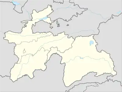
| Coordinates: 38°40′N 68°46′E / 38.667°N 68.767°E | |
| Country | |
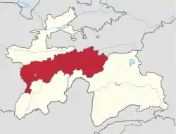
| Region | Districts of Republican Subordination |
| District | Varzob District |
| Population (2015) | |
| • Total | 31,585 |
| Time zone | UTC+5 (TJT) |
Chorbogh (Tajik: Чорбоғ, Persian: چهارباغ) is a village and jamoat in Tajikistan. It is located in Varzob District, one of the Districts of Republican Subordination. The jamoat has a total population of 31,585 (2015).[1] Villages: Araqchin, Gulbogh, Darai Bedho, Darai Foni, Dahana, Duoba, Kulihavoi, Mehrobod, Obizak, Sari Kutal, Chorbogh, Chormaghzakoni Bolo, Chormaghzakoni Poyon, Shodob, Sholiqunghurot, Yakkachughuz, Jangalak.
References
- ↑ Jamoat-level basic indicators, United Nations Development Programme in Tajikistan, accessed 15 October 2020
Capital: Dushanbe | |||||||||||||||||||||||
|  | ||||||||||||||||||||||
|
| |||||||||||||||||||||||
| |||||||||||||||||||||||
| |||||||||||||||||||||||
This article is issued from Wikipedia. The text is licensed under Creative Commons - Attribution - Sharealike. Additional terms may apply for the media files.