Connerré | |
|---|---|
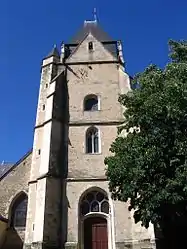 The church of Saint Symphorien | |
.svg.png.webp) Coat of arms | |
Location of Connerré | |
 Connerré 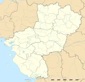 Connerré | |
| Coordinates: 48°03′42″N 0°29′45″E / 48.0617°N 0.4958°E | |
| Country | France |
| Region | Pays de la Loire |
| Department | Sarthe |
| Arrondissement | Mamers |
| Canton | Savigné-l'Évêque |
| Intercommunality | Le Gesnois Bilurien |
| Government | |
| • Mayor (2020–2026) | Arnaud Mongella[1] |
| Area 1 | 16.6 km2 (6.4 sq mi) |
| Population | 2,895 |
| • Density | 170/km2 (450/sq mi) |
| Demonym(s) | Conneréen, Conneréenne |
| Time zone | UTC+01:00 (CET) |
| • Summer (DST) | UTC+02:00 (CEST) |
| INSEE/Postal code | 72090 /72160 |
| Elevation | 60–145 m (197–476 ft) |
| 1 French Land Register data, which excludes lakes, ponds, glaciers > 1 km2 (0.386 sq mi or 247 acres) and river estuaries. | |
Connerré (French pronunciation: [kɔnɛʁe]) is a commune in the Sarthe department in the Pays de la Loire region of Northwestern France.
Geography
Connerré is best known as where the LGV Atlantique meets the LGV Bretagne-Pays de la Loire.
Population
| Year | Pop. | ±% p.a. |
|---|---|---|
| 1968 | 2,383 | — |
| 1975 | 2,523 | +0.82% |
| 1982 | 2,635 | +0.62% |
| 1990 | 2,545 | −0.43% |
| 1999 | 2,590 | +0.19% |
| 2007 | 2,872 | +1.30% |
| 2012 | 2,861 | −0.08% |
| 2017 | 2,902 | +0.28% |
| Source: INSEE[3] | ||
See also
References
- ↑ "Répertoire national des élus: les maires" (in French). data.gouv.fr, Plateforme ouverte des données publiques françaises. 13 September 2022.
- ↑ "Populations légales 2021". The National Institute of Statistics and Economic Studies. 28 December 2023.
- ↑ Population en historique depuis 1968, INSEE
Wikimedia Commons has media related to Connerré.
This article is issued from Wikipedia. The text is licensed under Creative Commons - Attribution - Sharealike. Additional terms may apply for the media files.