Daikoku Pier
大黒埠頭 | |
|---|---|
District | |
.jpg.webp) View of Daikoku Pier (center) | |
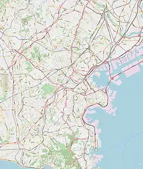 Daikoku Pier Location of Daikoku Pier 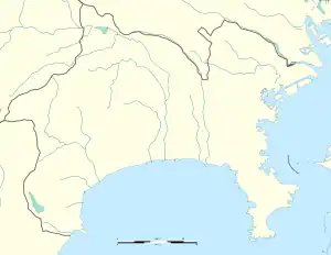 Daikoku Pier Daikoku Pier (Kanagawa Prefecture) | |
| Coordinates: 35°27′59.43″N 139°40′57.13″E / 35.4665083°N 139.6825361°E | |
| Country | |
| Prefecture | |
| Municipality | |
| Ward | Tsurumi-ku |
| Area | |
| • Total | 3.122 km2 (1.205 sq mi) |
| Population (December 31, 2017)[2] | |
| • Total | 0 |
| • Density | 0.0/km2 (0.0/sq mi) |
| Time zone | UTC+9 (Japan Standard Time) |
| Postal code | 230-0054[3] |
| Area code | 045[4] |
| Vehicle registration | 横浜 (Yokohama) |
Daikoku Pier (大黒埠頭, Daikokufutō) is an area of Tsurumi-ku, Yokohama, Kanagawa Prefecture. The pier was built as a freight base, but it also functions as a transportation hub for traffic around the Port of Yokohama. It is an access point for the Shuto Expressway and a docking point for large cruise ships. Since it is a hub for a wide variety of economic activities, huge bridges such as the Daikoku Ohashi Bridge and Yokohama Bay Bridge have been built.
References
- ↑ "横浜市町区域要覧". 横浜市. 2016-03-31. Retrieved 2018-01-24.
- ↑ "横浜の人口 - 登録者数(市・区・町・外国人) - 町丁別世帯と男女別人口". 横浜市. 2017-12-31. Retrieved 2018-01-24.
- ↑ "郵便番号". 日本郵便. Retrieved 2018-01-23.
- ↑ "市外局番の一覧". 総務省. Retrieved 2018-01-23.
This article is issued from Wikipedia. The text is licensed under Creative Commons - Attribution - Sharealike. Additional terms may apply for the media files.