Egnar, Colorado | |
|---|---|
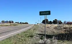 Entering Egnar along SH 141 from the south, April 2020 | |
| Coordinates: 37°55′04″N 108°56′26″W / 37.91778°N 108.94056°W | |
| Country | |
| State | |
| Counties | San Miguel[1] |
| Elevation | 7,329 ft (2,234 m) |
| Time zone | UTC-7 (MST) |
| • Summer (DST) | UTC-6 (MDT) |
| ZIP code[2] | 81325 |
| Area code | 970 |
Egnar is an unincorporated community in San Miguel County, Colorado, United States. Egnar has a U.S. Post Office with the ZIP Code 81325.[2]
History
A post office called Egnar has been in operation since 1917.[3] The community's name is "Range" spelled backward.[4]
See also
References
- 1 2 "US Board on Geographic Names". United States Geological Survey. October 25, 2007. Retrieved January 31, 2008.
- 1 2 "ZIP Code Lookup". United States Postal Service. December 15, 2006. Archived from the original (JavaScript/HTML) on November 22, 2010. Retrieved December 15, 2006.
- ↑ "Post offices". Jim Forte Postal History. Archived from the original on March 6, 2016. Retrieved June 25, 2016.
- ↑ Dawson, John Frank. Place names in Colorado: why 700 communities were so named, 150 of Spanish or Indian origin. Denver, CO: The J. Frank Dawson Publishing Co. p. 19.
External links
![]() Media related to Egnar at Wikimedia Commons
Media related to Egnar at Wikimedia Commons
Municipalities and communities of San Miguel County, Colorado, United States | ||
|---|---|---|
| Towns | 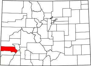 Map of Colorado highlighting San Miguel County | |
| CDP | ||
| Unincorporated communities | ||
| Ghost towns |
| |
This article is issued from Wikipedia. The text is licensed under Creative Commons - Attribution - Sharealike. Additional terms may apply for the media files.