| Eure | |
|---|---|
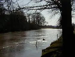 The Eure | |
.png.webp) | |
| Location | |
| Country | France |
| Physical characteristics | |
| Source | |
| • location | Normandy |
| • elevation | 240 m (790 ft) |
| Mouth | |
• location | Seine |
• coordinates | 49°17′42″N 1°02′27″E / 49.2950°N 1.0408°E |
| Length | 229 km (142 mi) |
| Basin size | 5,935 square kilometres (2,292 sq mi) |
| Discharge | |
| • average | 26 m3/s (920 cu ft/s) |
| Basin features | |
| Progression | Seine→ English Channel |
The Eure (English: /ɜːr/ ur; French pronunciation: [œʁ] ⓘ) is a river between Normandy and Centre-Val de Loire in north-western France, left tributary of the Seine.[1] It is 229 km (142 mi) long.[2] It rises at Marchainville in the Orne department and joins the Seine near Pont-de-l'Arche.[2] Two departments are named after the Eure, namely Eure and Eure-et-Loir.
Places along the river:
- Orne (61): Marchainville, La Lande-sur-Eure, Neuilly-sur-Eure.
- Eure-et-Loir (28): Courville-sur-Eure, Saint-Georges-sur-Eure, Fontenay-sur-Eure, Chartres, Saint-Prest, Maintenon, Nogent-le-Roi, Mézières-en-Drouais, Cherisy, Anet.
- Eure (27): Évreux, Ivry-la-Bataille, Garennes-sur-Eure, Bueil, Merey, Pacy-sur-Eure, Ménilles, Chambray, Croisy-sur-Eure, Autheuil-Authouillet, Acquigny, Louviers, Le Vaudreuil, Val de Reuil, Pont-de-l'Arche, Martot.
Its main tributaries are the Avre, the Iton and the Blaise from the left and the Voise, the Drouette and the Vesgre from the right.[2]
References
- ↑ "Eure River - river, France". Encyclopedia Britannica. Retrieved 17 February 2019.
- 1 2 3 Sandre. "Fiche cours d'eau - L'Eure (H4--0200)".
Wikimedia Commons has media related to Eure River.
This article is issued from Wikipedia. The text is licensed under Creative Commons - Attribution - Sharealike. Additional terms may apply for the media files.