Fontainemore | |
|---|---|
| Comune di Fontainemore Commune de Fontainemore | |
 | |
.svg.png.webp) Coat of arms | |
Location of Fontainemore | |
 Fontainemore Location of Fontainemore in Italy 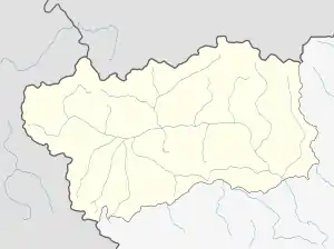 Fontainemore Fontainemore (Aosta Valley) | |
| Coordinates: 45°39′N 7°52′E / 45.650°N 7.867°E | |
| Country | Italy |
| Region | Aosta Valley |
| Province | none |
| Frazioni | Barme, Borney, Chuchal, Clapasson, Coré, Espaz, Farettaz, Niana, Pian Pervero, Pillaz, Planaz, Plan Coumarial, Versa |
| Area | |
| • Total | 31 km2 (12 sq mi) |
| Elevation | 760 m (2,490 ft) |
| Population (31 December 2022)[2] | |
| • Total | 418 |
| • Density | 13/km2 (35/sq mi) |
| Demonym | Fontainemoreins |
| Time zone | UTC+1 (CET) |
| • Summer (DST) | UTC+2 (CEST) |
| Postal code | 11020 |
| Dialing code | 0125 |
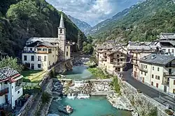
Fontainemore (Valdôtain: Fontènemore; Issime Walser: Pischu; Fontanamora from 1939 to 1946) is a town and comune in the Aosta Valley region of north-western Italy. It is one of I Borghi più belli d'Italia ("The most beautiful villages of Italy").[3]
Toponym
The toponym "Fontainemore" may derive from an old fountain called in French as « Fontaine de Saint-Maur » or « Fontaine de la mort ».[4]
Géographie
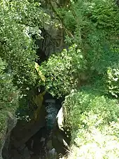
The Gouffre de Guillemore.
Fontainemore is located in the middle of the Lys Valley, near the chasm known as French: Gouffre de Guillemore. It is the most Eastern municipality of the Aosta Valley.
References
- ↑ "Superficie di Comuni Province e Regioni italiane al 9 ottobre 2011". Italian National Institute of Statistics. Retrieved 16 March 2019.
- ↑ "Popolazione Residente al 1° Gennaio 2018". Italian National Institute of Statistics. Retrieved 16 March 2019.
- ↑ "Valle d'Aosta" (in Italian). Retrieved 31 July 2023.
- ↑ Office du tourisme de la Vallée d'Aoste.
This article is issued from Wikipedia. The text is licensed under Creative Commons - Attribution - Sharealike. Additional terms may apply for the media files.