Itapetinga, Bahia, Brazil | |
|---|---|
Municipality | |
 Multisport Park of Pond (Parque Poliesportivo da Lagoa) in June festivities. | |
 Flag  Seal | |
 | |
| Country | |
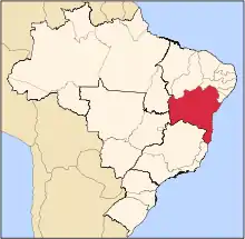
| Region | Nordeste |
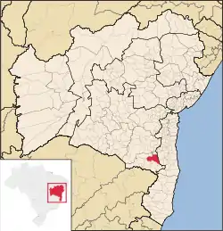
| State | Bahia |
| Government | |
| • Mayor | Rodrigo Hagge |
| Population (2020 [1]) | |
| • Total | 76,795 |
| Time zone | UTC−3 (BRT) |
Itapetinga, Bahia, Brazil is a municipality in the state of Bahia in the North-East region of Brazil.[2] Its population in 2020, according to estimates by the IBGE, was 76,795, so it is the 24th most populous municipality of Bahia.[3][4]
Sister cities
See also
External links
- Map of Itapetinga (Mapa de Itapetinga, in Portuguese) Up to now (June 2011) the only georeferenced street map with confirmed street names for this municipality.
References
- ↑ IBGE 2020
- ↑ "Divisão Territorial do Brasil" (in Portuguese). Divisão Territorial do Brasil e Limites Territoriais, Instituto Brasileiro de Geografia e Estatística (IBGE). July 1, 2008. Retrieved December 17, 2009.
- ↑ "Ranking decrescente do IDH-M dos municípios do Brasil" (in Portuguese). Atlas do Desenvolvimento Humano, Programa das Nações Unidas para o Desenvolvimento (PNUD). 2000. Archived from the original on October 3, 2009. Retrieved December 17, 2009.
- ↑ "Produto Interno Bruto dos Municípios 2002-2005" (PDF) (in Portuguese). Instituto Brasileiro de Geografia e Estatística (IBGE). December 19, 2007. Archived from the original (PDF) on October 2, 2008. Retrieved December 17, 2009.
- ↑ Sister Cities International Archived 2008-01-16 at the Wayback Machine
15°15′13″S 40°15′20″W / 15.2535°S 40.2555°W
This article is issued from Wikipedia. The text is licensed under Creative Commons - Attribution - Sharealike. Additional terms may apply for the media files.