Jatibonico | |
|---|---|
 | |
.png.webp) Jatibonico municipality (red) within Sancti Spíritus Province (yellow) and Cuba | |
| Coordinates: 21°56′47″N 79°10′3″W / 21.94639°N 79.16750°W | |
| Country | Cuba |
| Province | Sancti Spíritus |
| Area | |
| • Total | 765 km2 (295 sq mi) |
| Elevation | 347 m (1,138 ft) |
| Population (2004)[2] | |
| • Total | 42,708 |
| • Density | 55.8/km2 (145/sq mi) |
| Time zone | UTC-6 (EST) |
| Area code | +53-41-88xxxx |
| Website | https://jatibonico.gob.cu/ |
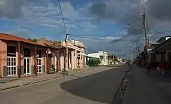
Jatibonico is a municipality and town in the Sancti Spíritus Province of Cuba.
Demographics
In 2012, the municipality of Jatibonico had a population of 42,959.[2] With a total area of 765 km2 (295 sq mi),[1] it has a population density of 55.8/km2 (145/sq mi).
Catholic Parish Church
A gallery of stained glass windows can be found at Jatibonico's St. Joseph Catholic Parish Church, unique in its kind in the whole of Cuba.[3]
Jatibonico Oil Field
The Jatibonico Oil Field was discovered in the early 1950s by Grupo Jarueca after surface oil seeps were noticed in the area. Oil was discovered at a depth of about 1,100 feet in a marly shale within a structural high. This was the first new field discovered in the post-World War II era and the start of several more fields in the Central Basin of Cuba.[4]
See also
References
- 1 2 Statoids (July 2003). "Municipios of Cuba". Retrieved 2007-10-07.
- 1 2 Atenas.cu (2004). "2004 Population trends, by Province and Municipality" (in Spanish). Archived from the original on 2007-09-27. Retrieved 2007-10-07.
- ↑ es:Parroquia de San José de Jatibonico y Arroyo Blanco
- ↑ Silvernail, John (2016). "The Cuban Oil Boom and the Discovery of Jatibonico Oil Field". AAPG Explorer. 37 (10): 20–21. Retrieved 4 October 2016.
External links
 Media related to Jatibonico at Wikimedia Commons
Places adjacent to Jatibonico | ||||||||||||||||
|---|---|---|---|---|---|---|---|---|---|---|---|---|---|---|---|---|
| ||||||||||||||||
This article is issued from Wikipedia. The text is licensed under Creative Commons - Attribution - Sharealike. Additional terms may apply for the media files.