Kisherend | |
|---|---|
 Coat of arms | |
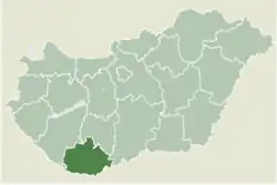 Location of Baranya county in Hungary | |
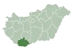
 Kisherend Location of Kisherend | |
| Coordinates: 45°57′57″N 18°19′57″E / 45.96571°N 18.33251°E | |
| Country | |
| County | Baranya |
| Area | |
| • Total | 6.92 km2 (2.67 sq mi) |
| Population (2004) | |
| • Total | 201 |
| • Density | 29.04/km2 (75.2/sq mi) |
| Time zone | UTC+1 (CET) |
| • Summer (DST) | UTC+2 (CEST) |
| Postal code | 7763 |
| Area code | 72 |
Kisherend (Croatian: Renda) is a village in Baranya county, Hungary.
External links
- Street map (in Hungarian)

This article is issued from Wikipedia. The text is licensed under Creative Commons - Attribution - Sharealike. Additional terms may apply for the media files.