Koggenland | |
|---|---|
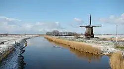 Wind mill in Koggenland | |
 Flag  Coat of arms | |
.svg.png.webp) Location in North Holland | |
| Coordinates: 52°38′N 4°57′E / 52.633°N 4.950°E | |
| Country | Netherlands |
| Province | North Holland |
| Established | 1 January 2007[1] |
| Government | |
| • Body | Municipal council |
| • Mayor | Rob Posthumus (VVD) |
| Area | |
| • Total | 84.08 km2 (32.46 sq mi) |
| • Land | 80.32 km2 (31.01 sq mi) |
| • Water | 3.76 km2 (1.45 sq mi) |
| Elevation | −3 m (−10 ft) |
| Population (January 2021)[5] | |
| • Total | 22,940 |
| • Density | 286/km2 (740/sq mi) |
| Time zone | UTC+1 (CET) |
| • Summer (DST) | UTC+2 (CEST) |
| Postcode | Parts of 1600 and 1700 range |
| Area code | 0226, 0229, 072 |
| Website | www |
Koggenland (West Frisian: Koggelân) is a municipality in North Holland province and the region of West-Frisia of the Netherlands. It came into existence on 1 January 2007 upon the merger of the two former municipalities of Obdam and Wester-Koggenland.
The name of the municipality refers to the historic Kogge from the middle-ages. A kogge or cogge was a jurisdiction area of several villages or bannen (mostly around 4 or 5).
Population centres
Villages:
- Avenhorn
- Berkhout
- Bobeldijk
- De Goorn
- Grosthuizen
- Hensbroek
- Obdam
- Oostmijzen
- Oudendijk
- Rustenburg
- Scharwoude
- Spierdijk
- Ursem
- Wogmeer
- Zuid-Spierdijk
- Zuidermeer
Hamlets:
- Baarsdorpermeer
- Berkmeer
- De Hulk
- Kathoek
- Noord-Spierdijk
- Noorddijk
- Noordermeer
- Oosteinde
- Obdammerdijk
Topography
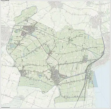
Dutch topographic map of the municipality of Koggenland, July 2015
Notable people
.JPG.webp)
Jetse Bol, 2015
- Bernard Claesen Speirdyke (1663, prob. in Spierdijk – 1670) a 17th-century Dutch buccaneer
- Jacob Clay (1882 in Berkhout – 1955) a Dutch physicist who studied cosmic rays
- Henk Jonker (1912 in Berkhout – 2002) a Dutch photographer, most active in World War II
- Sander Lantinga (born 1976 in Biddinghuizen) a radio & TV program maker, a radio-DJ and streaker[6]
Sport
Gallery
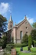 Nederlands Hervormde Kerk, achterzijde, Berkhout
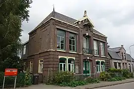 Voormalig Raadhuis, Grosthuizen
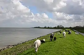 Markermeer dike near Scharwoude
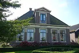 Anna Hoeve, Berkhout
References
- ↑ "Gemeentelijke indeling op 1 januari 2007" [Municipal divisions on 1 January 2007]. cbs.nl (in Dutch). CBS. Retrieved 12 March 2014.
- ↑ "College van B&W" [Board of mayor and aldermen] (in Dutch). Gemeente Koggenland. Archived from the original on 12 March 2014. Retrieved 12 March 2014.
- ↑ "Kerncijfers wijken en buurten 2020" [Key figures for neighbourhoods 2020]. StatLine (in Dutch). CBS. 24 July 2020. Retrieved 19 September 2020.
- ↑ "Postcodetool for 1648JG". Actueel Hoogtebestand Nederland (in Dutch). Het Waterschapshuis. Archived from the original on 21 September 2013. Retrieved 12 March 2014.
- ↑ "Bevolkingsontwikkeling; regio per maand" [Population growth; regions per month]. CBS Statline (in Dutch). CBS. 1 January 2021. Retrieved 2 January 2022.
- ↑ IMDb Database retrieved 08 April 2020
External links
 Media related to Koggenland at Wikimedia Commons
- Official website
Places adjacent to Koggenland | ||||||||||||||||
|---|---|---|---|---|---|---|---|---|---|---|---|---|---|---|---|---|
| ||||||||||||||||

This article is issued from Wikipedia. The text is licensed under Creative Commons - Attribution - Sharealike. Additional terms may apply for the media files.