Kolia | |
|---|---|
Town, sub-prefecture, and commune | |
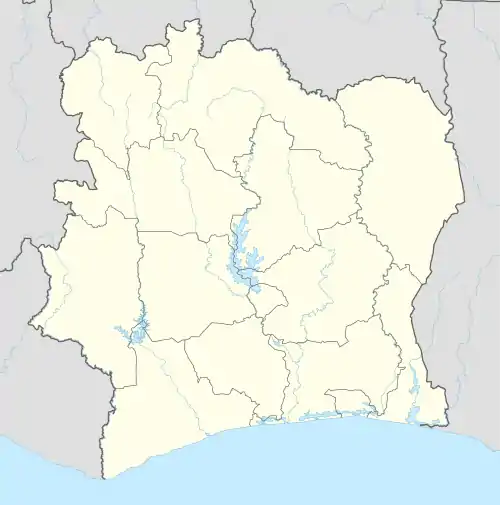 Kolia Location in Ivory Coast | |
| Coordinates: 9°48′N 6°28′W / 9.800°N 6.467°W | |
| Country | |
| District | Savanes |
| Region | Bagoué |
| Department | Kouto |
| Area | |
| • Total | 1,110 km2 (430 sq mi) |
| Population (2021 census)[1] | |
| • Total | 32,113 |
| • Density | 29/km2 (75/sq mi) |
| • Town | 12,124[2] |
| (2014 census) | |
| Time zone | UTC+0 (GMT) |
Kolia is a town in northern Ivory Coast. It is a sub-prefecture and commune of Kouto Department in Bagoué Region, Savanes District.
In 2021, the population of the sub-prefecture of Kolia was 32,113.[1]
Villages
The 10 villages of the sub-prefecture of Kolia and their population in 2014 are :[2]
- Kolia (12 124)
- Blediemene (1 341)
- Dabakaha (50)
- Mararanama (2 521)
- Fanhandougou (1 259)
- Katanra (1 242)
- Kodiaga (327)
- Koro (1 489)
- Kpafonon (1 702)
- Monongo (2 793)
Notes
- 1 2 Citypopulation.de Population of the regions and sub-prefectures of Ivory Coast
- 1 2 Citypopulation.de Population of the localities in the sub-prefecture of Kolia
Regional seat: Boundiali | ||
| Boundiali Department | 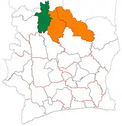 | |
| Kouto Department | ||
| Tengréla Department | ||
* also a commune | ||
This article is issued from Wikipedia. The text is licensed under Creative Commons - Attribution - Sharealike. Additional terms may apply for the media files.