Koundara | |
|---|---|
Sub-prefecture and town | |
 | |
 Koundara Location in Guinea | |
| Coordinates: 12°29′N 13°18′W / 12.483°N 13.300°W | |
| Country | |
| Region | Boké Region |
| Prefecture | Koundara Prefecture |
| Population (2014 census) | |
| • Total | 27,433 |
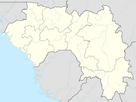
Koundara is a town in northwestern Guinea, near the borders of Guinea-Bissau and Senegal. It is the capital of Koundara Prefecture. The town is served by Sambailo Airport. As of 2014 it had a population of 27,433 people.[1]
Climate
Koundara has a tropical savanna climate (Köppen climate classification Aw), with the temperature being hot year round, and with a wet and dry season. On 29 March 2017, Koundara recorded a temperature of 45.0 °C (113.0 °F), which is the highest temperature to have ever been recorded in Guinea.[2]
| Climate data for Koundara (1991–2020) | |||||||||||||
|---|---|---|---|---|---|---|---|---|---|---|---|---|---|
| Month | Jan | Feb | Mar | Apr | May | Jun | Jul | Aug | Sep | Oct | Nov | Dec | Year |
| Mean daily maximum °C (°F) | 35.3 (95.5) |
37.9 (100.2) |
39.8 (103.6) |
40.7 (105.3) |
39.3 (102.7) |
35.0 (95.0) |
32.1 (89.8) |
31.3 (88.3) |
32.0 (89.6) |
33.4 (92.1) |
34.4 (93.9) |
34.5 (94.1) |
35.5 (95.9) |
| Daily mean °C (°F) | 25.2 (77.4) |
27.9 (82.2) |
30.5 (86.9) |
32.0 (89.6) |
31.7 (89.1) |
28.9 (84.0) |
27.0 (80.6) |
26.5 (79.7) |
26.7 (80.1) |
27.5 (81.5) |
26.7 (80.1) |
24.6 (76.3) |
27.9 (82.2) |
| Mean daily minimum °C (°F) | 15.0 (59.0) |
18.0 (64.4) |
21.2 (70.2) |
23.4 (74.1) |
24.0 (75.2) |
22.9 (73.2) |
21.9 (71.4) |
21.6 (70.9) |
21.4 (70.5) |
21.7 (71.1) |
19.1 (66.4) |
14.4 (57.9) |
20.4 (68.7) |
| Average precipitation mm (inches) | 0.1 (0.00) |
0.0 (0.0) |
0.5 (0.02) |
0.7 (0.03) |
34.1 (1.34) |
142.1 (5.59) |
229.4 (9.03) |
333.1 (13.11) |
293.4 (11.55) |
89.9 (3.54) |
6.2 (0.24) |
0.2 (0.01) |
1,129.7 (44.48) |
| Average precipitation days (≥ 1.0 mm) | 0.0 | 0.0 | 0.0 | 0.1 | 3.2 | 9.9 | 14.2 | 18.7 | 17.7 | 7.1 | 0.5 | 0.1 | 71.5 |
| Source: NOAA[3] | |||||||||||||
References
- ↑ "Guinea". Institut National de la Statistique, Guinea, accessed via Geohive. Archived from the original on 24 November 2015. Retrieved 27 August 2014.
- ↑ Masters, Jeff (18 January 2018). "NOAA: Earth Had Its Third Warmest Year on Record in 2017". Wunderground. Archived from the original on 30 April 2018. Retrieved 16 April 2022.
- ↑ "World Meteorological Organization Climate Normals for 1991-2020 — Koundara". National Oceanic and Atmospheric Administration. Retrieved January 4, 2024.
12°29′N 13°18′W / 12.483°N 13.300°W
Capital: Koundara | ||
| Sub-prefectures | 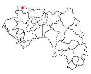 | |
This article is issued from Wikipedia. The text is licensed under Creative Commons - Attribution - Sharealike. Additional terms may apply for the media files.