Kretinga Area Eldership
Kretingos seniūnija | |
|---|---|
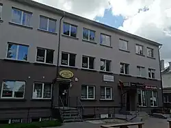 Administration building | |
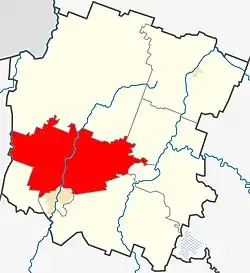 Location of Kretinga Area Eldership | |
| Coordinates: 55°56′13″N 21°16′01″E / 55.937°N 21.267°E | |
| Country | |
| Ethnographic region | Samogitia |
| County | Klaipėda County |
| Municipality | Kretinga District Municipality |
| Administrative centre | Kretinga |
| Area | |
| • Total | 145 km2 (56 sq mi) |
| Population (2021)[1] | |
| • Total | 4,849 |
| • Density | 33/km2 (87/sq mi) |
| Time zone | UTC+2 (EET) |
| • Summer (DST) | UTC+3 (EEST) |
Kretinga Area Eldership (Lithuanian: Kretingos seniūnija) is a Lithuanian eldership, located in the western part of Kretinga District Municipality.
Populated places
Following settlements are located in the Kretinga Area Eldership (as for the 2021 census)[2]
| Locality | Total |
|---|---|
| Ankštakiai | 80 |
| Daktarai | 33 |
| Dimitravas | 10 |
| Genčai | 48 |
| Grykšiai | 11 |
| Klibiai | 250 |
| Kretingsodis | 1210 |
| Kurmaičiai | 557 |
| Kveciai | 250 |
| Padvariai | 1481 |
| Rūdaičiai | 475 |
| Tarvydai | 106 |
| Tinteliai | 21 |
| Tūbausiai | 176 |
| Užpelkiai | 35 |
| Voveraičiai | 26 |
| Žibininkai | 47 |
References
- ↑ "2021 census". Statistikos Departamentas (Lithuania). Retrieved November 10, 2021.
- ↑ "GYVENTOJAI GYVENAMOSIOSE VIETOVĖSE". Osp.stat.gov.lt. Archived from the original (XLSX) on 7 March 2022. Retrieved 17 July 2022.
This article is issued from Wikipedia. The text is licensed under Creative Commons - Attribution - Sharealike. Additional terms may apply for the media files.