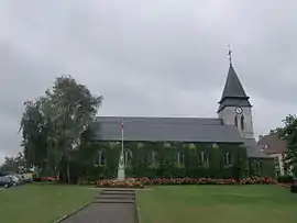
Le Bosc-Roger-en-Roumois | |
|---|---|
Part of Bosroumois | |
 | |
.svg.png.webp) Coat of arms | |
Location of Le Bosc-Roger-en-Roumois | |
 Le Bosc-Roger-en-Roumois 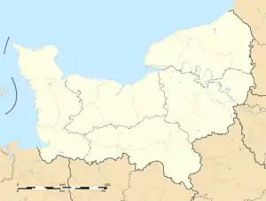 Le Bosc-Roger-en-Roumois | |
| Coordinates: 49°17′26″N 0°55′30″E / 49.2906°N 0.925°E | |
| Country | France |
| Region | Normandy |
| Department | Eure |
| Arrondissement | Bernay |
| Canton | Bourgtheroulde-Infreville |
| Commune | Bosroumois |
| Area 1 | 9.9 km2 (3.8 sq mi) |
| Population (2019)[1] | 3,323 |
| • Density | 340/km2 (870/sq mi) |
| Time zone | UTC+01:00 (CET) |
| • Summer (DST) | UTC+02:00 (CEST) |
| Postal code | 27670 |
| Elevation | 107–162 m (351–531 ft) (avg. 140 m or 460 ft) |
| 1 French Land Register data, which excludes lakes, ponds, glaciers > 1 km2 (0.386 sq mi or 247 acres) and river estuaries. | |
Le Bosc-Roger-en-Roumois (French pronunciation: [lə bo ʁɔʒe ɑ̃ ʁumwa]) is a former commune in the Eure department in Normandy in northern France. On 1 January 2017, it was merged into the new commune Bosroumois.[2]
Population
| Year | Pop. | ±% |
|---|---|---|
| 1962 | 962 | — |
| 1968 | 1,162 | +20.8% |
| 1975 | 1,647 | +41.7% |
| 1982 | 2,323 | +41.0% |
| 1990 | 2,895 | +24.6% |
| 1999 | 3,003 | +3.7% |
| 2008 | 3,241 | +7.9% |
See also
References
- ↑ Téléchargement du fichier d'ensemble des populations légales en 2019, INSEE
- ↑ Arrêté préfectoral 3 August 2016 (in French)
Wikimedia Commons has media related to Le Bosc-Roger-en-Roumois.
This article is issued from Wikipedia. The text is licensed under Creative Commons - Attribution - Sharealike. Additional terms may apply for the media files.