Mahasoa | |
|---|---|
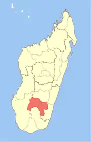
 Mahasoa Location in Madagascar | |
| Coordinates: 21°59′S 45°57′E / 21.983°S 45.950°E | |
| Country | |
| Region | Ihorombe |
| District | Ihosy |
| Elevation | 748 m (2,454 ft) |
| Population (2018)Cenus | |
| • Total | 24,877 |
| Time zone | UTC3 (EAT) |
| Postal code | 313 |
Mahasoa is a rural municipality in Madagascar. It belongs to the district of Ihosy, which is a part of Ihorombe Region. The population was 24877 inhabitants in 2018.
Primary and junior level secondary education are available in town. The majority 98% of the population of the commune are farmers. The most important crop is rice, while other important products are peanuts, maize and cassava. Additionally fishing employs 2% of the population.[2]
References
- ↑ Estimated based on DEM data from Shuttle Radar Topography Mission
- ↑ "ILO census data". Cornell University. 2002. Retrieved 2008-04-24.
21°59′S 45°57′E / 21.983°S 45.950°E
This article is issued from Wikipedia. The text is licensed under Creative Commons - Attribution - Sharealike. Additional terms may apply for the media files.