| Meng | |
|---|---|
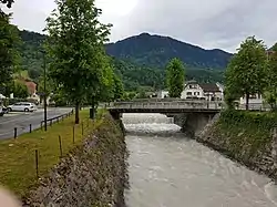 The Meng in Nenzing | |
| Location | |
| Country | Austria |
| State | Voralberg |
| Physical characteristics | |
| Source | |
| • location | Near the Naafkopf mountain |
| • coordinates | 47°03′18″N 9°37′51″E / 47.0550°N 9.6309°E |
| • elevation | about 2,390 metres (7,840 ft) |
| Mouth | |
• location | At Nenzing into the Ill |
• coordinates | 47°11′29″N 9°42′51″E / 47.1913°N 9.7142°E |
| Length | 18 kilometres (11 mi) |
| Basin features | |
| Progression | Ill→ Rhine→ North Sea |
The Meng is a river in Voralberg, Austria.
The Meng is 18 kilometres (11 mi) long. It originates near the Naafkopf mountain.[1] It flows through the valley Gamperdonatal in a northern direction. At the municipality of Nenzing, it discharges into the Ill.[2]
The Gampbach, a river of 5 kilometres (3.1 mi) length, flows from the right side into the middle section of the Meng.[3]
References
- ↑ Google (7 February 2020). "Meng source" (Map). Google Maps. Google. Retrieved 7 February 2020.
- ↑ Google (7 February 2020). "Meng mouth" (Map). Google Maps. Google. Retrieved 7 February 2020.
- ↑ Google (7 February 2020). "Gampbach mouth" (Map). Google Maps. Google. Retrieved 7 February 2020.
This article is issued from Wikipedia. The text is licensed under Creative Commons - Attribution - Sharealike. Additional terms may apply for the media files.