Mengkofen | |
|---|---|
_Mengkofen.JPG.webp) Mengkofen Castle | |
 Coat of arms | |
Location of Mengkofen within Dingolfing-Landau district 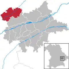 | |
 Mengkofen 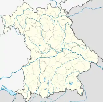 Mengkofen | |
| Coordinates: 48°43′N 12°26′E / 48.717°N 12.433°E | |
| Country | Germany |
| State | Bavaria |
| Admin. region | Niederbayern |
| District | Dingolfing-Landau |
| Subdivisions | 10 Ortschaften |
| Government | |
| • Mayor (2020–26) | Thomas Hieninger[1] (CSU) |
| Area | |
| • Total | 86.00 km2 (33.20 sq mi) |
| Elevation | 398 m (1,306 ft) |
| Population (2022-12-31)[2] | |
| • Total | 6,107 |
| • Density | 71/km2 (180/sq mi) |
| Time zone | UTC+01:00 (CET) |
| • Summer (DST) | UTC+02:00 (CEST) |
| Postal codes | 84152 |
| Dialling codes | 08733, 08774, 09427 |
| Vehicle registration | DGF |
| Website | Official website |
Mengkofen is a municipality in the district of Dingolfing-Landau in Bavaria in Germany. It lies in the Aiterach River valley.
Subdivision
The municipality includes 10 former municipalities (Gemarkungen), and other villages:[3]
- Hofdorf
- Hüttenkofen
- Martinsbuch
- Mengkofen
- Mühlhausen
- Puchhausen
- Süßkofen
- Ginhart
- Hagenau
- Tunding
- Tunzenberg
- Weichshofen
References
- ↑ Liste der ersten Bürgermeister/Oberbürgermeister in kreisangehörigen Gemeinden, Bayerisches Landesamt für Statistik, 15 July 2021.
- ↑ Genesis Online-Datenbank des Bayerischen Landesamtes für Statistik Tabelle 12411-003r Fortschreibung des Bevölkerungsstandes: Gemeinden, Stichtag (Einwohnerzahlen auf Grundlage des Zensus 2011)
- ↑ (in German) Infos at municipal website
Wikimedia Commons has media related to Mengkofen.
Towns and municipalities in Dingolfing-Landau | ||
|---|---|---|
This article is issued from Wikipedia. The text is licensed under Creative Commons - Attribution - Sharealike. Additional terms may apply for the media files.