Microregion of Nhandeara | |
|---|---|
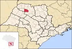 Location of the Microregion of Nhandeara | |
| Coordinates: 20°41′38″S 50°02′16″W / 20.69389°S 50.03778°W | |
| Country | |
| Region | Southeast |
| State | |
| Mesoregion | São José do Rio Preto |
| Area | |
| • Total | 2,016.7 km2 (778.7 sq mi) |
| Population (2010/IBGE) | |
| • Total | 65,337 |
| • Density | 32/km2 (84/sq mi) |
| Time zone | UTC-3 (UTC-3) |
| • Summer (DST) | UTC-2 (UTC-2) |
| Postal Code | 15190-000 |
| Area code | +55 17 |
The Microregion of Nhandeara (Portuguese: Microrregião de Nhandeara) is located on the northwest of São Paulo state, Brazil, and is made up of 9 municipalities. It belongs to the Mesoregion of São José do Rio Preto.
The microregion has a population of 65,337 inhabitants, in an area of 2,016.7 km²[1]
Municipalities
The microregion consists of the following municipalities,[2] listed below with their 2010 Census populations (IBGE/2010):[3]
- Macaubal: 7,663
- Monções: 2,132
- Monte Aprazível: 21,746
- Neves Paulista: 8,772
- Nhandeara: 10,725
- Nipoã: 4,274
- Poloni: 5,395
- Sebastianópolis do Sul: 3,031
- União Paulista: 1,599
References
- ↑ "2010 Census of the IBGE - Synopsis - Tables 761 and 1301" (in Portuguese). IBGE.gov.br. Retrieved 13 July 2011.
- ↑ Instituto Brasileiro de Geografia e Estatística, territorial division.
- ↑ "2010 Census of the IBGE - Population - Table 2.1.20" (PDF). IBGE.gov.br. Retrieved 13 July 2011.
| Mesoregions |
|
|---|---|
| Microregions |
|
This article is issued from Wikipedia. The text is licensed under Creative Commons - Attribution - Sharealike. Additional terms may apply for the media files.