Municipio XIII di Roma | |
|---|---|
Municipio of Rome | |
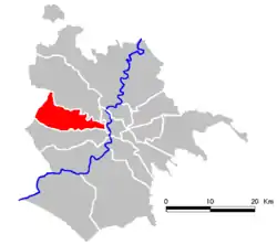 Location of Municipio XIII of Rome | |
| Country | Italy |
| Region | Lazio |
| Comune | Rome |
| Government | |
| • President | Sabrina Giuseppetti (Democratic Party) |
| Area | |
| • Total | 7.69 sq mi (19.91 km2) |
| Population (2010) | |
| • Total | 137,633 |
| • Density | 5,190/sq mi (2,004/km2) |
| Time zone | UTC+1 (CET) |
| • Summer (DST) | UTC+2 (CEST) |
Municipio XIII is an administrative subdivision of the city of Rome. It was first created by Rome's City Council on 19 January 2001 and it has a president who is elected during the mayoral elections.
Originally called Municipio XVIII, since 11 March 2013 its borders were modified and its name changed in Municipio XIII.[1]
Subdivision
Municipio XIII is divided in six urbanisms zones:
| Locality |
Inhabitants 31 December 2010 |
| 18a Aurelio Sud |
27,372 |
| 18b Val Cannuta |
35,548 |
| 18c Fogaccia |
30,705 |
| 18d Aurelio Nord |
19,405 |
| 18e Casalotti di Booccea |
17,089 |
| 18f Boccea |
7,309 |
| Not localized |
205 |
Politics
Current allocation of seats in the Municipio XIII's parliamentary body as of the 2013 Rome municipal election:
- Democratic Party (PD) 13
- People of Freedom (PdL) 5
- Left Ecology Freedom 2
- Five Star Movement (M5S) 2
- Others 2
In May 2013 Valentino Mancinelli (PD) was elected president. The current majority is formed by Democratic Party and Left Ecology Freedom.
References
- ↑ "Roma, sì all'accorpamento dei municipi: il Consiglio li riduce da 19 a 15". Il Messaggero. 11 March 2013. Retrieved 13 March 2013.
External links
![]() Media related to Municipio XIII (Rome) at Wikimedia Commons
Media related to Municipio XIII (Rome) at Wikimedia Commons
41°44′0″N 12°17′06″E / 41.73333°N 12.28500°E
This article is issued from Wikipedia. The text is licensed under Creative Commons - Attribution - Sharealike. Additional terms may apply for the media files.