Neunheilingen | |
|---|---|
Location of Neunheilingen | |
 Neunheilingen 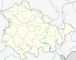 Neunheilingen | |
| Coordinates: 51°12′N 10°40′E / 51.200°N 10.667°E | |
| Country | Germany |
| State | Thuringia |
| District | Unstrut-Hainich-Kreis |
| Town | Nottertal-Heilinger Höhen |
| Area | |
| • Total | 14.57 km2 (5.63 sq mi) |
| Elevation | 251 m (823 ft) |
| Population (2018-12-31) | |
| • Total | 459 |
| • Density | 32/km2 (82/sq mi) |
| Time zone | UTC+01:00 (CET) |
| • Summer (DST) | UTC+02:00 (CEST) |
| Postal codes | 99947 |
| Dialling codes | 036043 |
Neunheilingen is a village and a former municipality in the Unstrut-Hainich-Kreis district of Thuringia, Germany. Since December 2019, it is part of the town Nottertal-Heilinger Höhen. A hoard of early Bronze Age weapons was found in the vicinity of Neunheilingen in the nineteenth century and is now kept at the British Museum in London.[1]
References
This article is issued from Wikipedia. The text is licensed under Creative Commons - Attribution - Sharealike. Additional terms may apply for the media files.