Nová Lesná | |
|---|---|
Municipality | |
.jpg.webp) | |
 Coat of arms | |
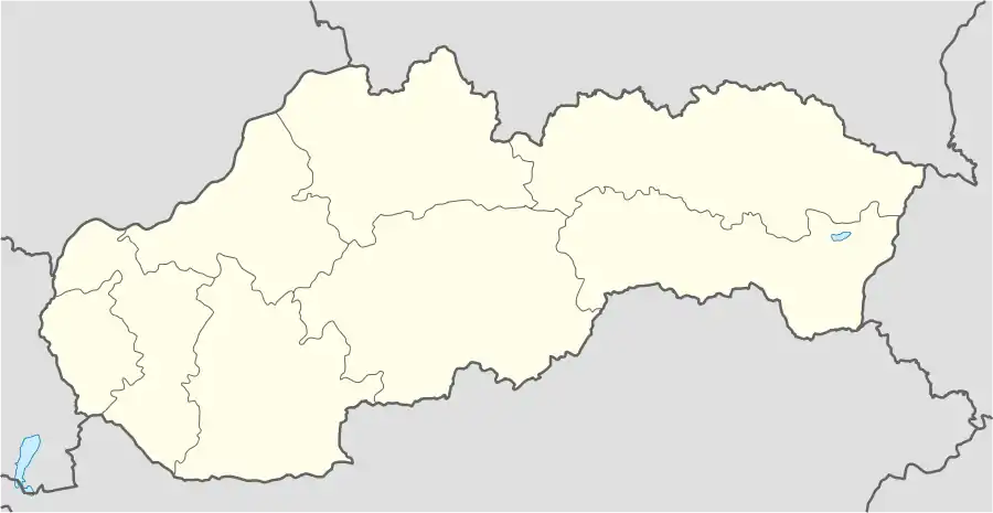 Nová Lesná Location of Nová Lesná in Slovakia | |
| Coordinates: 49°07′20″N 20°16′02″E / 49.12222°N 20.26722°E | |
| Country | Slovakia |
| Region | Prešov |
| District | Poprad |
| Area | |
| • Total | 4.10[1] km2 (1.58[1] sq mi) |
| Elevation | 748[2] m (2,454[2] ft) |
| Population (2021) | |
| • Total | 1,660[3] |
| Postal code | 059 91[2] |
| Area code | +421 52[2] |
| Car plate | PP |
Nová Lesná (German: Neu Walddorf) is a village and municipality in Poprad District in the Prešov Region of northern Slovakia.
Geography
The municipality lies at an altitude of 747 metres and covers an area of 4.159 km². It has a population of about 1520 people.
History
In historical records the village was first mentioned in 1315. It belonged to a German language island. The German population was expelled in 1945.
Economy and infrastructure
Tourism dominates the village economy. In Nová Lesná are several pensions and developed tourist infrastructure.
References
- 1 2 "Hustota obyvateľstva - obce [om7014rr_ukaz: Rozloha (Štvorcový meter)]". www.statistics.sk (in Slovak). Statistical Office of the Slovak Republic. 2022-03-31. Retrieved 2022-03-31.
- 1 2 3 4 "Základná charakteristika". www.statistics.sk (in Slovak). Statistical Office of the Slovak Republic. 2015-04-17. Retrieved 2022-03-31.
- ↑ "Počet obyvateľov podľa pohlavia - obce (ročne)". www.statistics.sk (in Slovak). Statistical Office of the Slovak Republic. 2022-03-31. Retrieved 2022-03-31.
External links
- http://www.novalesna.sk
- https://web.archive.org/web/20160731032411/http://novalesna.e-obce.sk/
- Satellite map of Nová Lesná
- Nová Lesná at vysoketatry.com
Municipalities of Poprad District | ||
|---|---|---|
This article is issued from Wikipedia. The text is licensed under Creative Commons - Attribution - Sharealike. Additional terms may apply for the media files.