Panposh | |
|---|---|
Town | |
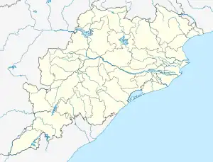 Panposh Location in Odisha, India  Panposh Panposh (India) | |
| Coordinates: 22°15′N 84°48′E / 22.25°N 84.80°E | |
| Country | |
| State | Odisha |
| District | Sundargarh |
| Elevation | 183 m (600 ft) |
| Population (2001) | |
| • Total | 10,227 |
| Languages | |
| • Official | Odia |
| Time zone | UTC+5:30 (IST) |
| Vehicle registration | OD |
| Website | odisha |
Panposh is a census town in Sundargarh district in the Indian state of Odisha.It is a part of Rourkela City.
Demographics
As of 2001 India census,[1] Panposh had a population of 10,227. Males constitute 51% of the population and females 49%. Panposh has an average literacy rate of 67%, higher than the national average of 59.5%: male literacy is 74%, and female literacy is 61%. In Panposh, 12% of the population is under 6 years of age.
Transport
Panposh is a station on the Tatanagar–Bilaspur section of Howrah-Nagpur-Mumbai line.
References
- ↑ "Census of India 2001: Data from the 2001 Census, including cities, villages and towns (Provisional)". Census Commission of India. Archived from the original on 16 June 2004. Retrieved 1 November 2008.
This article is issued from Wikipedia. The text is licensed under Creative Commons - Attribution - Sharealike. Additional terms may apply for the media files.