Route 365 | ||||
|---|---|---|---|---|
 | ||||
| Route information | ||||
| Maintained by Transports Québec | ||||
| Length | 28 km[1] (17 mi) | |||
| Major junctions | ||||
| North end | ||||
| South end | ||||
| Location | ||||
| Country | Canada | |||
| Province | Quebec | |||
| Major cities | Saint-Raymond-de-Portneuf, Neuville | |||
| Highway system | ||||
| ||||

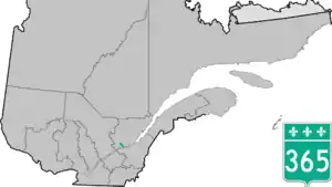
Route 365 is a 28 km north–south regional road in Quebec, Canada, linking Neuville and Saint-Raymond. It is the main road linking Autoroute 40 (exit 281) and the Quebec City area to St-Raymond and Pont-Rouge.
Pont-Rouge is the only city it goes through, where it overlaps Route 358 for only 400 meters.
Municipalities along Route 365
- Saint-Raymond-de-Portneuf
- Pont-Rouge
- Neuville
See also
References
- ↑ Ministère des transports, "Distances routières", page (?), Les Publications du Québec, 2005
External links
- Provincial Route Map (Courtesy of the Quebec Ministry of Transportation) (in French)
- Route 365 on Google Maps
This article is issued from Wikipedia. The text is licensed under Creative Commons - Attribution - Sharealike. Additional terms may apply for the media files.