Rabou | |
|---|---|
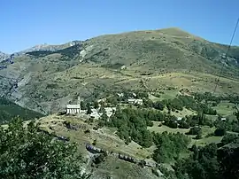 The village of Rabou and the summit of Puy, at 1,834 m (6,017 ft) | |
Location of Rabou | |
 Rabou 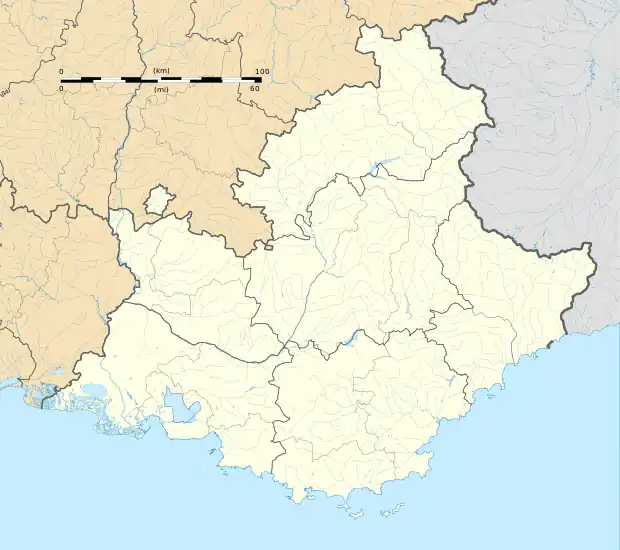 Rabou | |
| Coordinates: 44°35′30″N 6°00′22″E / 44.5917°N 6.0061°E | |
| Country | France |
| Region | Provence-Alpes-Côte d'Azur |
| Department | Hautes-Alpes |
| Arrondissement | Gap |
| Canton | Veynes |
| Intercommunality | Buëch Dévoluy |
| Government | |
| • Mayor (2020–2026) | Fabien Gascard[1] |
| Area 1 | 26.56 km2 (10.25 sq mi) |
| Population | 89 |
| • Density | 3.4/km2 (8.7/sq mi) |
| Time zone | UTC+01:00 (CET) |
| • Summer (DST) | UTC+02:00 (CEST) |
| INSEE/Postal code | 05112 /05400 |
| Elevation | 1,020–2,280 m (3,350–7,480 ft) (avg. 933 m or 3,061 ft) |
| 1 French Land Register data, which excludes lakes, ponds, glaciers > 1 km2 (0.386 sq mi or 247 acres) and river estuaries. | |
Rabou (French pronunciation: [ʁabu]; Occitan: Rabòu) is a commune in the Hautes-Alpes department in southeastern France.
Population
| Year | Pop. | ±% p.a. |
|---|---|---|
| 1968 | 34 | — |
| 1975 | 33 | −0.43% |
| 1982 | 31 | −0.89% |
| 1990 | 46 | +5.06% |
| 1999 | 67 | +4.27% |
| 2007 | 77 | +1.75% |
| 2012 | 78 | +0.26% |
| 2017 | 79 | +0.26% |
| Source: INSEE[3] | ||
See also
References
- ↑ "Répertoire national des élus: les maires". data.gouv.fr, Plateforme ouverte des données publiques françaises (in French). 2 December 2020.
- ↑ "Populations légales 2021". The National Institute of Statistics and Economic Studies. 28 December 2023.
- ↑ Population en historique depuis 1968, INSEE
Wikimedia Commons has media related to Rabou.
This article is issued from Wikipedia. The text is licensed under Creative Commons - Attribution - Sharealike. Additional terms may apply for the media files.