Ruilhe | |
|---|---|
 Coat of arms | |
 | |
| Coordinates: 41°29′56″N 8°30′00″W / 41.499°N 8.500°W | |
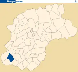
| Country | |
| Region | Norte |
| Intermunic. comm. | Cávado |
| District | Braga |
| Municipality | Braga |
| Area | |
| • Total | 2.20 km2 (0.85 sq mi) |
| Population (2011) | |
| • Total | 1,142 |
| • Density | 520/km2 (1,300/sq mi) |
| Time zone | UTC±00:00 (WET) |
| • Summer (DST) | UTC+01:00 (WEST) |
Ruilhe is a Portuguese parish, located in the municipality of Braga. The population in 2011 was 1,142,[1] in an area of 2.20 km².[2]
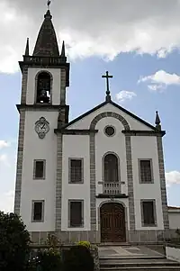
Ruilhe Church
References
This article is issued from Wikipedia. The text is licensed under Creative Commons - Attribution - Sharealike. Additional terms may apply for the media files.