Saint-Amable | |
|---|---|
 | |
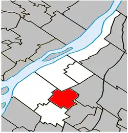 Location within Marguerite-D'Youville RCM. | |
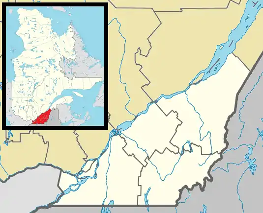 Saint-Amable Location in southern Quebec. | |
| Coordinates: 45°39′N 73°18′W / 45.650°N 73.300°W[1] | |
| Country | Canada |
| Province | Quebec |
| Region | Montérégie |
| RCM | Marguerite-D'Youville |
| Constituted | June 13, 1921 |
| Government | |
| • Mayor | François Gamache |
| • Federal riding | Pierre-Boucher—Les Patriotes—Verchères |
| • Prov. riding | Verchères |
| Area | |
| • Total | 37.00 km2 (14.29 sq mi) |
| • Land | 36.81 km2 (14.21 sq mi) |
| Population (2016)[5] | |
| • Total | 12,167 |
| • Density | 330.6/km2 (856/sq mi) |
| • Pop 2011-2016 | |
| • Dwellings | 4,672 |
| Time zone | UTC−05:00 (EST) |
| • Summer (DST) | UTC−04:00 (EDT) |
| Postal code(s) | |
| Area code(s) | 450 and 579 |
| Highways | |
| Website | www |
Saint-Amable is a town 38.1 km (23.7 mi)[6] east of Montreal in southwestern Quebec, Canada, within the Marguerite-D'Youville Regional County Municipality. The population as of the 2016 Canadian Census was 12,167.
History
The city, founded on 21 June 1921, is named after Amable de Riom, a popular saint from the period of New France (1534-1763).
Demographics
| Year | Pop. | ±% |
|---|---|---|
| 1991 | 5,804 | — |
| 1996 | 7,105 | +22.4% |
| 2001 | 7,278 | +2.4% |
| 2006 | 8,398 | +15.4% |
| 2011 | 10,870 | +29.4% |
| 2016 | 12,167 | +11.9% |
In the 2021 Census of Population conducted by Statistics Canada, Saint-Amable had a population of 13,322 living in 5,105 of its 5,190 total private dwellings, a change of 9.5% from its 2016 population of 12,167. With a land area of 36.77 km2 (14.20 sq mi), it had a population density of 362.3/km2 (938.4/sq mi) in 2021.[8]
| 2021 | 2016 | 2011 | |
|---|---|---|---|
| Population | 13,322 (+9.5% from 2016) | 12,167 (+11.3% from 2011) | 10,870 (+29.4% from 2006) |
| Land area | 36.77 km2 (14.20 sq mi) | 36.81 km2 (14.21 sq mi) | 36.68 km2 (14.16 sq mi) |
| Population density | 362.3/km2 (938/sq mi) | 330.6/km2 (856/sq mi) | 296.3/km2 (767/sq mi) |
| Median age | 36.4 (M: 36.4, F: 36.4) | 34.9 (M: 35.2, F: 34.6) | 33.5 (M: 33.8, F: 33.2) |
| Private dwellings | 5,105 (total) | 4,672 (total) | 4,122 (total) |
| Median household income | $75,599 | $70,325 |
| Canada Census Mother Tongue - Saint-Amable, Quebec[7] | ||||||||||||||||||
|---|---|---|---|---|---|---|---|---|---|---|---|---|---|---|---|---|---|---|
| Census | Total | French |
English |
French & English |
Other | |||||||||||||
| Year | Responses | Count | Trend | Pop % | Count | Trend | Pop % | Count | Trend | Pop % | Count | Trend | Pop % | |||||
2016 |
12,170 |
11,600 | 95.3% | 150 | 1.2% | 70 | 0.6% | 305 | 2.5% | |||||||||
2011 |
10,835 |
10,405 | 96.03% | 165 | 1.52% | 40 | 0.37% | 225 | 2.08% | |||||||||
2006 |
8,395 |
8,150 | 97.08% | 95 | 1.13% | 15 | 0.18% | 135 | 1.61% | |||||||||
2001 |
7,265 |
7,105 | 97.80% | 80 | 1.10% | 15 | 0.21% | 65 | 0.89% | |||||||||
1996 |
7,090 |
6,930 | n/a | 97.74% | 75 | n/a | 1.06% | 15 | n/a | 0.21% | 70 | n/a | 0.99% | |||||
Economy
Within the fertile area between the Saint Lawrence and Richelieu rivers, Saint-Amable has agriculture as its main economic activity.
See also
References
- ↑ "Banque de noms de lieux du Québec: Reference number 137709". toponymie.gouv.qc.ca (in French). Commission de toponymie du Québec.
- 1 2 Ministère des Affaires municipales, des Régions et de l'Occupation du territoire: Saint-Amable
- ↑ Parliament of Canada Federal Riding History: VERCHÈRES--LES PATRIOTES (Quebec)
- ↑ "Census Profile, 2016 Census - Saint-Amable, Municipalité [Census subdivision], Quebec and Joliette [Census agglomeration], Quebec". 8 February 2017.
- ↑ "Census Profile, 2016 Census - Saint-Amable, Municipalité [Census subdivision], Quebec and Joliette [Census agglomeration], Quebec". 8 February 2017.
- ↑ Google Maps
- 1 2 Statistics Canada: 1996, 2001, 2006, 2011, 2016 census
- ↑ "Population and dwelling counts: Canada, provinces and territories, and census subdivisions (municipalities), Quebec". Statistics Canada. February 9, 2022. Retrieved August 29, 2022.
- ↑ "2021 Community Profiles". 2021 Canadian Census. Statistics Canada. February 4, 2022. Retrieved 2022-04-27.
- ↑ "2016 Community Profiles". 2016 Canadian Census. Statistics Canada. August 12, 2021. Retrieved 2022-04-28.
- ↑ "2011 Community Profiles". 2011 Canadian Census. Statistics Canada. March 21, 2019. Retrieved 2014-05-18.
- ↑ "2006 Community Profiles". 2006 Canadian Census. Statistics Canada. August 20, 2019.
- ↑ "2001 Community Profiles". 2001 Canadian Census. Statistics Canada. July 18, 2021.
External links
Adjacent Municipal Subdivisions | |
|---|---|
| Cities | |
|---|---|
| Municipalities | |
| |