Sainte-Maure | |
|---|---|
.JPG.webp) Chateau | |
 Coat of arms | |
Location of Sainte-Maure | |
 Sainte-Maure 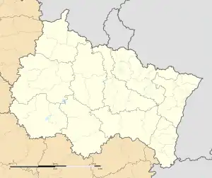 Sainte-Maure | |
| Coordinates: 48°20′43″N 4°03′44″E / 48.3453°N 4.0622°E | |
| Country | France |
| Region | Grand Est |
| Department | Aube |
| Arrondissement | Troyes |
| Canton | Creney-près-Troyes |
| Intercommunality | CA Troyes Champagne Métropole |
| Government | |
| • Mayor (2020–2026) | Denis Pottier[1] |
| Area 1 | 20.92 km2 (8.08 sq mi) |
| Population | 1,766 |
| • Density | 84/km2 (220/sq mi) |
| Time zone | UTC+01:00 (CET) |
| • Summer (DST) | UTC+02:00 (CEST) |
| INSEE/Postal code | 10352 /10150 |
| 1 French Land Register data, which excludes lakes, ponds, glaciers > 1 km2 (0.386 sq mi or 247 acres) and river estuaries. | |
Sainte-Maure (French pronunciation: [sɛ̃t mɔʁ]) is a commune in the Aube department in Grand Est region, France.
Population
| Year | Pop. | ±% |
|---|---|---|
| 1962 | 665 | — |
| 1968 | 706 | +6.2% |
| 1975 | 1,003 | +42.1% |
| 1982 | 1,178 | +17.4% |
| 1990 | 1,218 | +3.4% |
| 1999 | 1,211 | −0.6% |
| 2008 | 1,421 | +17.3% |
See also
References
- ↑ "Répertoire national des élus: les maires". data.gouv.fr, Plateforme ouverte des données publiques françaises (in French). 2 December 2020.
- ↑ "Populations légales 2021". The National Institute of Statistics and Economic Studies. 28 December 2023.
Wikimedia Commons has media related to Sainte-Maure.
This article is issued from Wikipedia. The text is licensed under Creative Commons - Attribution - Sharealike. Additional terms may apply for the media files.