Samar Gewog
ས་དམར་ | |
|---|---|
 Samar Gewog | |
| Coordinates: 27°17′56″N 89°15′13″E / 27.2988°N 89.2537°E | |
| Country | |
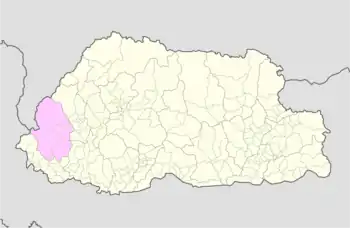
| District | Haa District |
| Time zone | UTC+6 (BTT) |
Samar Gewog (Dzongkha: ས་དམར་) is a gewog (village block) of Haa District, Bhutan.[1] In 2002, the gewog had an area of 361.7 square kilometres and contains 244 households.[2]
References
- ↑ "Chiwogs in Haa" (PDF). Election Commission, Government of Bhutan. 2011. Retrieved 2011-07-28.
- ↑ "Sama Gewog Ninth Plan (2002-2007)" (PDF). Haa Dzongkhag Royal Government of Bhutan. Retrieved August 25, 2010.
This article is issued from Wikipedia. The text is licensed under Creative Commons - Attribution - Sharealike. Additional terms may apply for the media files.