Samtse
་བསམ་རྩེ | |
|---|---|
Village | |
 Samtse Location in Bhutan | |
| Coordinates: 27°2′N 89°5′E / 27.033°N 89.083°E | |
| Country | |
| District | Samtse |
| Elevation | 417 m (1,368 ft) |
| Population (2017) | |
| • Total | 5,396 |
| Time zone | UTC+6 (BTT) |
Samtse is a town and the headquarters of the Samtse District in Bhutan. The population of the town was 5,396 as of 2017.[1] The population of the Samtse district was 60,100 at the 2005 census.[2]
Samtse is close to the Bhutan–India border. Across the border is the Indian town of Chamurchi.
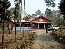
Post office in Samtse, Bhutan
Climate
Samtse features a dry-winter humid subtropical climate (Köppen Cwa) with very heavy rainfall in summer.
| Climate data for Samtse, 1996–2018 | |||||||||||||
|---|---|---|---|---|---|---|---|---|---|---|---|---|---|
| Month | Jan | Feb | Mar | Apr | May | Jun | Jul | Aug | Sep | Oct | Nov | Dec | Year |
| Mean daily maximum °C (°F) | 21.3 (70.3) |
23.5 (74.3) |
26.6 (79.9) |
28.2 (82.8) |
28.6 (83.5) |
28.9 (84.0) |
28.5 (83.3) |
29.2 (84.6) |
29.2 (84.6) |
28.6 (83.5) |
25.9 (78.6) |
23.3 (73.9) |
26.8 (80.3) |
| Mean daily minimum °C (°F) | 12.9 (55.2) |
15.1 (59.2) |
18.2 (64.8) |
20.4 (68.7) |
21.5 (70.7) |
23.2 (73.8) |
23.6 (74.5) |
23.9 (75.0) |
23.2 (73.8) |
21.1 (70.0) |
17.6 (63.7) |
14.7 (58.5) |
19.6 (67.3) |
| Average precipitation mm (inches) | 20.1 (0.79) |
39.1 (1.54) |
147.7 (5.81) |
333.3 (13.12) |
635.6 (25.02) |
1,051.2 (41.39) |
1,213 (47.76) |
1,065.2 (41.94) |
669.9 (26.37) |
208.7 (8.22) |
21.2 (0.83) |
14.4 (0.57) |
5,419.4 (213.36) |
| Average precipitation days (≥ 0.1 mm) | 2.5 | 4.3 | 8.7 | 15.1 | 21.0 | 25.7 | 28.8 | 27.7 | 22.1 | 10.3 | 2.6 | 1.6 | 170.4 |
| Source: World Meteorological Organization[3] | |||||||||||||
References
- ↑ "Bhutan: Districts & Major Towns - Population Statistics, Maps, Charts, Weather and Web Information". Archived from the original on 2003-10-05. Retrieved 2021-10-08.
- ↑ "Annual Dzongkhag Statistics 2010" (PDF). National Statistics Bureau. Archived (PDF) from the original on 18 November 2017. Retrieved 4 May 2014.
- ↑ "World Weather Information Service – Samtse". World Meteorological Organization. Retrieved November 1, 2022.
This article is issued from Wikipedia. The text is licensed under Creative Commons - Attribution - Sharealike. Additional terms may apply for the media files.