Saulxures-lès-Bulgnéville | |
|---|---|
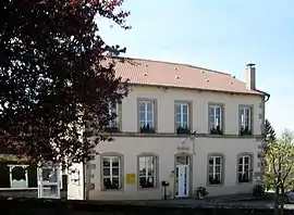 The town hall in Saulxures-lès-Bulgnéville | |
 Coat of arms | |
Location of Saulxures-lès-Bulgnéville | |
 Saulxures-lès-Bulgnéville 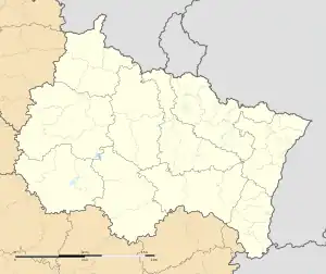 Saulxures-lès-Bulgnéville | |
| Coordinates: 48°11′52″N 5°48′28″E / 48.1978°N 5.8078°E | |
| Country | France |
| Region | Grand Est |
| Department | Vosges |
| Arrondissement | Neufchâteau |
| Canton | Vittel |
| Intercommunality | CC Terre d'eau |
| Government | |
| • Mayor (2020–2026) | Sylvain Gloriot[1] |
| Area 1 | 9.54 km2 (3.68 sq mi) |
| Population | 237 |
| • Density | 25/km2 (64/sq mi) |
| Time zone | UTC+01:00 (CET) |
| • Summer (DST) | UTC+02:00 (CEST) |
| INSEE/Postal code | 88446 /88140 |
| Elevation | 322–451 m (1,056–1,480 ft) (avg. 380 m or 1,250 ft) |
| 1 French Land Register data, which excludes lakes, ponds, glaciers > 1 km2 (0.386 sq mi or 247 acres) and river estuaries. | |
Saulxures-lès-Bulgnéville (French pronunciation: [solsyʁ lɛ bylɲevil] ⓘ, literally Saulxures near Bulgnéville) is a commune in the Vosges department in Grand Est in northeastern France.
See also
References
- ↑ "Répertoire national des élus: les maires" (in French). data.gouv.fr, Plateforme ouverte des données publiques françaises. 13 September 2022.
- ↑ "Populations légales 2021". The National Institute of Statistics and Economic Studies. 28 December 2023.
Wikimedia Commons has media related to Saulxures-lès-Bulgnéville.
This article is issued from Wikipedia. The text is licensed under Creative Commons - Attribution - Sharealike. Additional terms may apply for the media files.