| Slieve Meelbeg | |
|---|---|
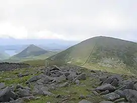 Slieve Meelbeg from Slieve Meelmore | |
| Highest point | |
| Elevation | 702 m (2,303 ft) |
| Prominence | 182 m (597 ft) |
| Listing | Marilyn |
| Coordinates | 54°11′02″N 6°00′30″W / 54.18375°N 6.00827°W |
| Geography | |
| Location | County Down, Northern Ireland |
| Parent range | Mourne Mountains |
| OSI/OSNI grid | J3008027889 |
Slieve Meelbeg is a mountain located in the Mourne Mountains. It is a popular hiking destination and is 5.5 miles (8.9 km) east of the village of Hilltown.[1]
References
- ↑ "Walk NI- Meelbeg". Walkni.com. Retrieved 29 March 2015.
This article is issued from Wikipedia. The text is licensed under Creative Commons - Attribution - Sharealike. Additional terms may apply for the media files.