Stanstead-Est | |
|---|---|
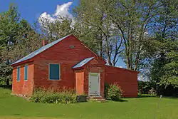 Mansur Rural School in Stanstead-Est | |
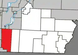 Location within Coaticook RCM. | |
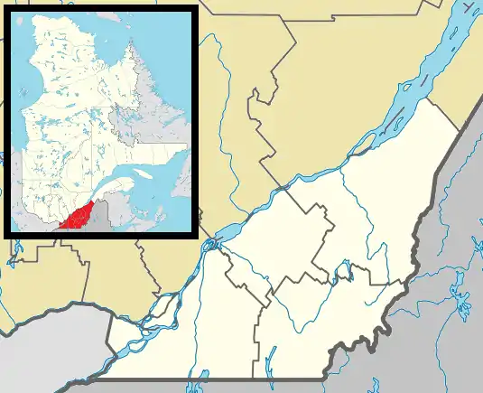 Stanstead Est Location in southern Quebec. | |
| Coordinates: 45°06′N 72°03′W / 45.100°N 72.050°W[1] | |
| Country | |
| Province | |
| Region | Estrie |
| RCM | Coaticook |
| Constituted | July 16, 1932 |
| Government | |
| • Mayor | PAMELA B. STEEN |
| • Federal riding | Compton—Stanstead |
| • Prov. riding | Saint-François |
| Area | |
| • Total | 116.10 km2 (44.83 sq mi) |
| • Land | 114.54 km2 (44.22 sq mi) |
| Population | |
| • Total | 642 |
| • Density | 5.6/km2 (15/sq mi) |
| • Pop 2016-2021 | |
| • Dwellings | 314 |
| Time zone | UTC−5 (EST) |
| • Summer (DST) | UTC−4 (EDT) |
| Postal code(s) | |
| Area code | 819 |
| Highways | |
Stanstead-Est is a municipality in Quebec.
Demographics
Population
Population trend:[4]
| Census | Population | Change (%) |
|---|---|---|
| 2021 | 642 | |
| 2016 | 584 | |
| 2011 | 603 | |
| 2006 | 628 | |
| 2001 | 661 | |
| 1996 | 668 | |
| 1991 | 686 | N/A |
See also
References
- ↑ "Banque de noms de lieux du Québec: Reference number 60706". toponymie.gouv.qc.ca (in French). Commission de toponymie du Québec.
- 1 2 "Répertoire des municipalités: Geographic code 44050". www.mamh.gouv.qc.ca (in French). Ministère des Affaires municipales et de l'Habitation.
- 1 2 "Profile table, Census Profile, 2021 Census of Population - Stanstead-Est, Municipalité (MÉ) [Census subdivision], Quebec". 9 February 2022.
- ↑ Statistics Canada: 1996, 2001, 2006, 2011, 2016, 2021 census
Places adjacent to Stanstead-Est | |
|---|---|
| Cities | |
|---|---|
| Municipalities | |
| Townships | |
| Communities | |
| |
This article is issued from Wikipedia. The text is licensed under Creative Commons - Attribution - Sharealike. Additional terms may apply for the media files.