Viitasaari | |
|---|---|
Town | |
| Viitasaaren kaupunki Viitasaari stad | |
 | |
 Coat of arms | |
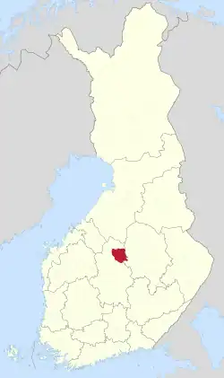 Location of Viitasaari in Finland | |
| Coordinates: 63°04′30″N 025°51′35″E / 63.07500°N 25.85972°E | |
| Country | |
| Region | Central Finland |
| Sub-region | Saarijärvi–Viitasaari sub-region |
| Charter | 1635 |
| Town privileges | 1996 |
| Government | |
| • Municipal manager | Helena Vuopionperä-Kovanen |
| Area (2018-01-01)[1] | |
| • Total | 1,589.13 km2 (613.57 sq mi) |
| • Land | 1,248.53 km2 (482.06 sq mi) |
| • Water | 340.43 km2 (131.44 sq mi) |
| • Rank | 59th largest in Finland |
| Elevation | 140 m (460 ft) |
| Population (2023-09-30)[2] | |
| • Total | 5,882 |
| • Rank | 154th largest in Finland |
| • Density | 4.71/km2 (12.2/sq mi) |
| Population by native language | |
| • Finnish | 97.8% (official) |
| • Swedish | 0.2% |
| • Others | 2% |
| Population by age | |
| • 0 to 14 | 11.6% |
| • 15 to 64 | 51.9% |
| • 65 or older | 36.5% |
| Time zone | UTC+02:00 (EET) |
| • Summer (DST) | UTC+03:00 (EEST) |
| Postal code | 44500 |
| Area code | (+358) 01 |
| Website | www |
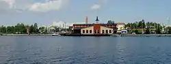
Viitasaari is a town and municipality of Finland.
It is located in the Central Finland region. The town has a population of 5,882 (30 September 2023)[5] and covers an area of 1,589.13 square kilometres (613.57 sq mi) of which 340.43 km2 (131.44 sq mi) is water.[1] There are all together 230 lakes in Viitasaari. Biggest lakes are Lake Keitele, Lake Kolima and Muuruejärvi.[6] The population density is 4.71 inhabitants per square kilometre (12.2/sq mi).
The municipality is unilingually Finnish.
Politics
Results of the 2023 Finnish parliamentary election in Viitasaari:[7]
- Social Democratic Party 31.2%
- Centre Party 24.6%
- Finns Party 20.5%
- National Coalition Party 7.9%
- Christian Democrats 6.7%
- Left Alliance 4.2%
- Green League 2.3%
Sister cities
The following cities or municipalities are twinned with Viitasaari:[8][9]
 Nõo Parish, Estonia
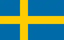 Staffanstorp Municipality, Sweden
- Storuman Municipality, Sweden
 Sør-Odal, Norway
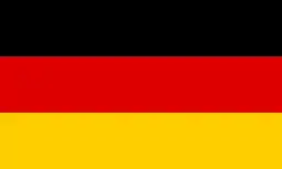 Schlangen, Germany
 Rokietnica, Poland
See also
- Blue Highway, an international tourist route
References
- 1 2 "Area of Finnish Municipalities 1.1.2018" (PDF). National Land Survey of Finland. Retrieved 30 January 2018.
- ↑ "Preliminary population statistics 2023, September". StatFin. Statistics Finland. Retrieved 26 October 2023.
- ↑ "Demographic Structure by area as of 31 December 2022". Statistics Finland's PX-Web databases. Statistics Finland. Retrieved 6 September 2023.
- ↑ "Population according to age (1-year) and sex by area and the regional division of each statistical reference year, 2003–2020". StatFin. Statistics Finland. Retrieved 2 May 2021.
- ↑ "Population by municipality as of 31 December 2006". Population Information System (in Finnish and Swedish). Population Register Center of Finland. Retrieved 2 May 2010.
- ↑ "Viitasaari". Järviwiki. Finland's Environmental Administration. 2012. Retrieved 27 February 2012.
- ↑ "Viitasaari | Tulospalvelu | Eduskuntavaalit 2023 | yle.fi". vaalit.yle.fi (in Finnish). Retrieved 2023-10-20.
- ↑ "Ystävyyskunnat" (in Norwegian). City of Viitasaari. Archived from the original on 2012-06-04. Retrieved 2012-06-01.
- ↑ "Välissuhted" (in Estonian). Nõo vald. Retrieved 2 May 2012.
External links
![]() Media related to Viitasaari at Wikimedia Commons
Media related to Viitasaari at Wikimedia Commons
- Town of Viitasaari – Official website
Places adjacent to Viitasaari | ||||||||||||||||
|---|---|---|---|---|---|---|---|---|---|---|---|---|---|---|---|---|
| ||||||||||||||||
| Municipalities | ||
|---|---|---|
| Former municipalities | ||
This article is issued from Wikipedia. The text is licensed under Creative Commons - Attribution - Sharealike. Additional terms may apply for the media files.